Wow, it’s been almost three weeks since I posted anything! I actually had to take a look to see where we had left off. We are now in week 7 of our trip. Only 5 weeks to go. Time has flown.
We finally departed New Mexico, having spent far more time there than we thought we would. We made a quick one night stop in Bisbee, Arizona. There is an abandoned underground copper mine there (yes, another mine). The campground we stayed at is right on the edge of an abandoned open pit mine. You want to talk about a view! We did the mine tour and spent one night on the edge of the pit. Been there, done that.
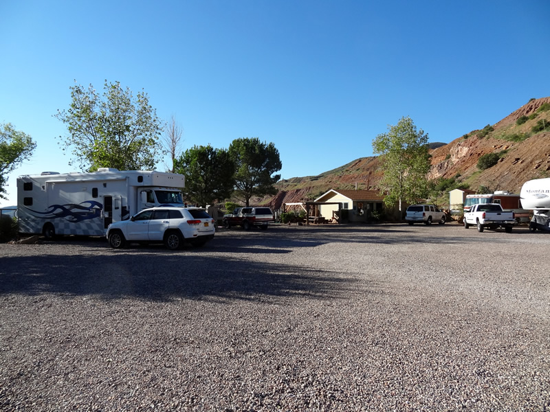
Camped on the edge of an open pit mine.
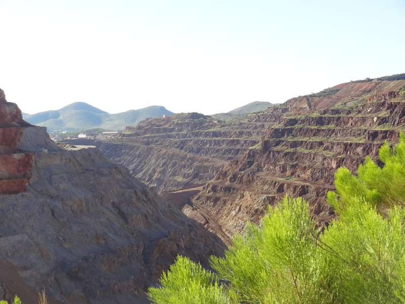
The view out the RV bedroom window!
Leaving Bisbee, we came across this sight in the town of Sierra Vista, Arizona. Was that a blimp (the little white spec towards the top)? I quickly asked Google “Why is a blimp flying over Sierra Vista?” I got an answer. It’s a radar blimp keeping tabs on illegal air traffic from across the border. Who knew?
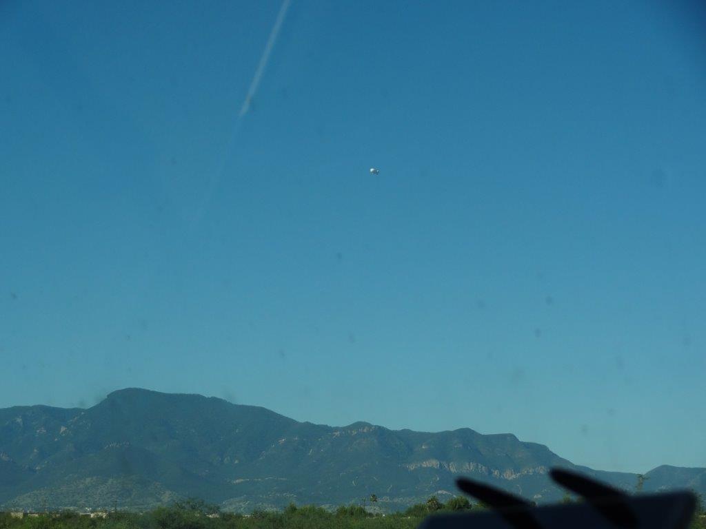
That speck is the sky is a blimp carrying air traffic radar. It’s been there for 30 years. Ignore the bug smudges on the windshield.
We finally arrived in Green Valley, Arizona where my parents live. We’ve been going there for 22 years and this was a family visit. So other than this terrific rainbow over the campground one evening, there is not much to show. We timed our arrival to make sure we were set with a place to stay over the Labor Day weekend. It turns out, when it is 100 degrees in Southern Arizona, getting a campsite is no problem at all (unlike in New York!).
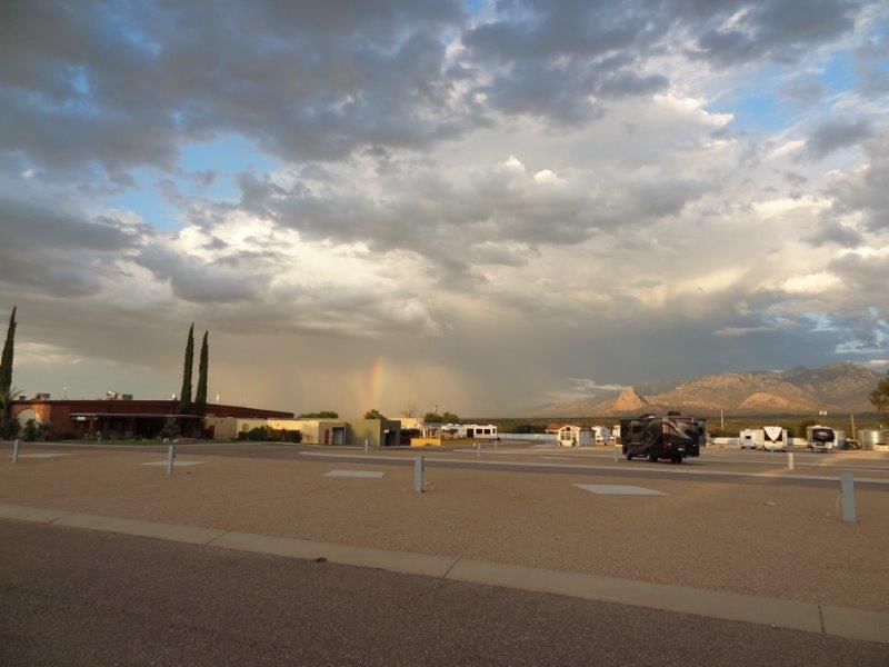
Monsoon storm east of our not-crowded campground on Labor Day weekend.
We departed Green Valley the Tuesday after Labor Day and got out just before the remnants of a tropical storm dumped rain on the area. Yes, we do know how to time our departure.
Q: Where’s your next destination?
A: Wherever it’s sunny.
After a 13 hour drive, we arrived, more than slightly worn out, in Visaila, California. Once arriving, we learned that we were in California’s Central Valley where half the nation’s produce comes from. It was strange seeing parched hillsides with lush citrus orchards in the valley.
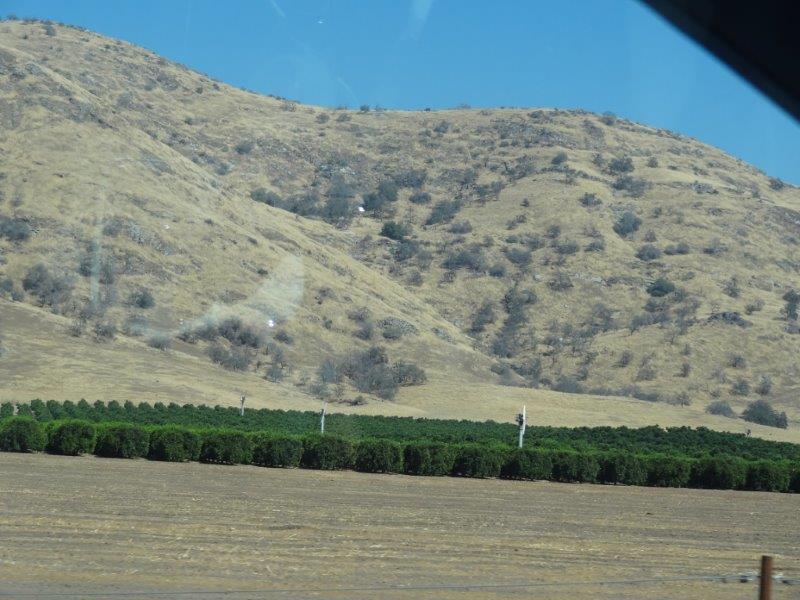
Dry hillside with a definitely irrigated orchard below it.
Our main reason for stopping in Visaila was to visit Sequoia National Park. And that’s what we did. WOW!
First we took a hike to the top of Moro Rock, a granite dome. The view was spectacular, if not a little foggy and/or smoggy. We could see the Sierra Nevada peaks to our east.We also experienced an inversion, where all the dirty air gets trapped in the valley between two mountain ranges. After the blue skies of New Mexico and Arizona, it was a little jarring to see a brown haze over the horizon. Yuck. This apparently is very common in California’s Central Valley.
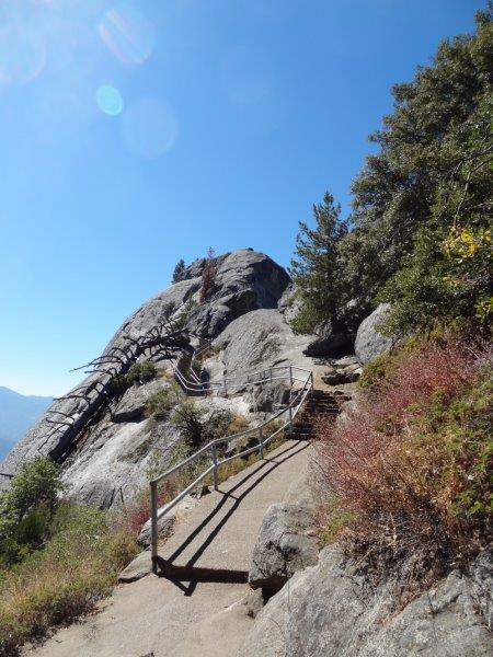
Stairway to the top of Moro Rock.
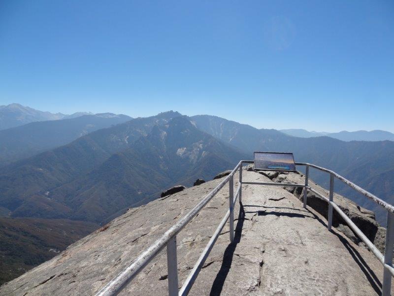
The destination, on top of the world.
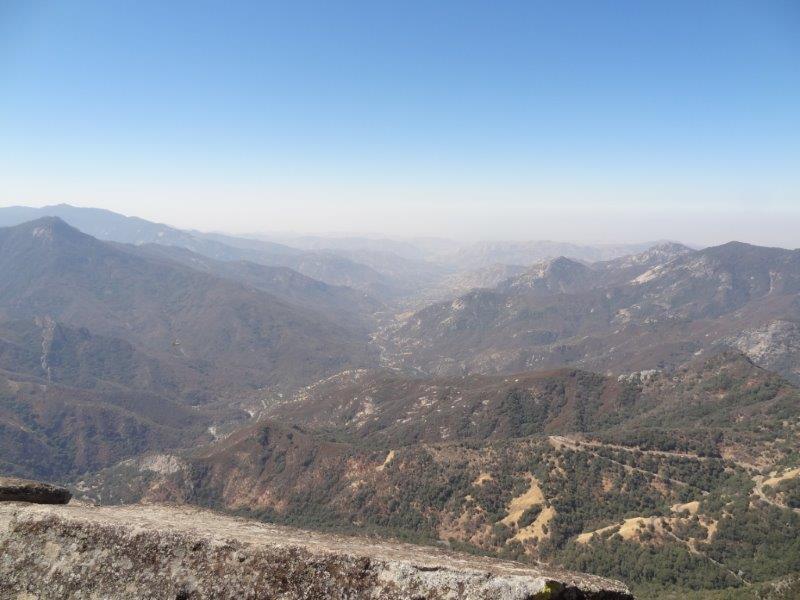
The valley we drove up, and the smog.
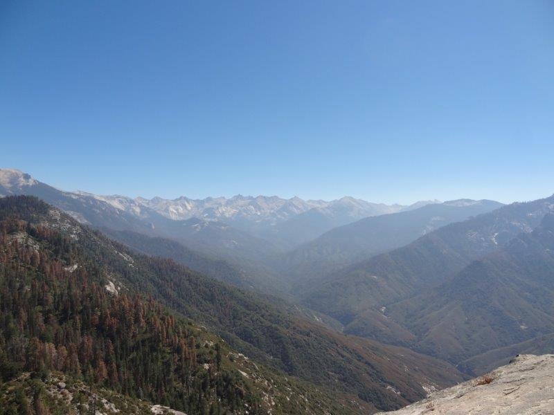
Sierra Nevada Mountains
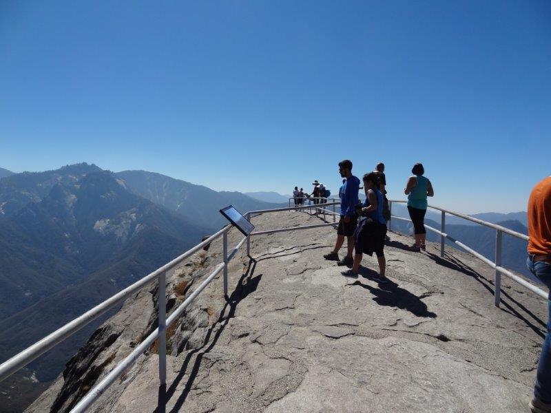
Me viewing people viewing…
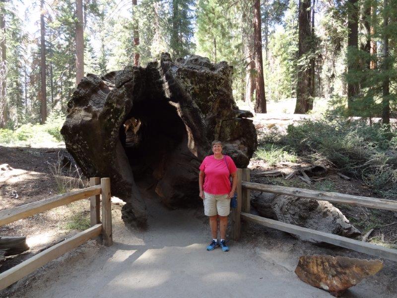
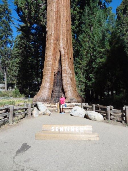
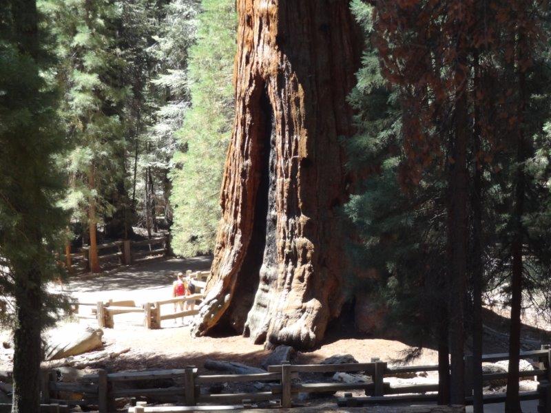
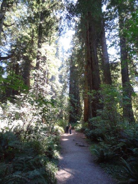
The great Sequoia trees only grow in this area of the world. And they were HUGE. In fact, they are the largest trees in the world. When you first drive into a grove of them, you are astounded by their size! 19 feet in diameter is not uncommon. And the trunks are almost straight up. The bark is up to 31 inches thick, which is why these trees survive fires so well. In fact, they need the heat of a forest fire to clean underlying brush and release the seeds from their cones. Yes, we got quite an education. I usually don’t like to put cars or people (especially me) in the pictures. But you have to in this case just to get a sense of scale. Otherwise the trees look a normal size.
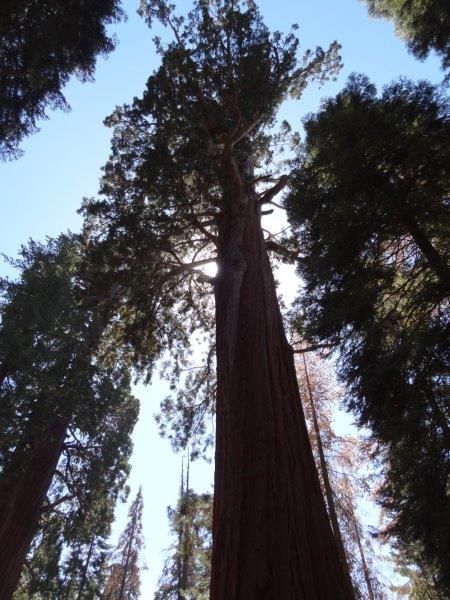
Look wayyyyy up.
A downed tree. People lived in this hollow trunk in the early 1900’s.
Big tree, little person.
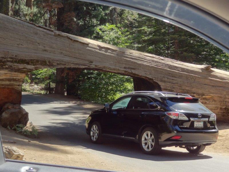
A downed tree trunk that you can drive through. We did.
This is the second largest tree in the world. The people in the picture give you a sense of how large these trees are.
We then pushed on to Northern California. We made a quick overnight stop in Sacramento to visit with friends from our early Kodak days (if you know us from back in the 80’s, then the names “Mark and Nancy” will be very familiar). Sorry, we neglected to get pictures. But it was a great visit!
The next stop was Redwood National Park in Northern California, just south of the Oregon/California state line. Ahhh. Finally, cooler weather! The Redwoods, while impressive, didn’t seem as overwhelming as the Sequoias. What’s the difference? Here…
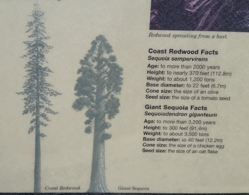
Redwoods are taller. Sequoias have larger trunks. By volume, Sequoias are bigger.
Again, big trees, little people.
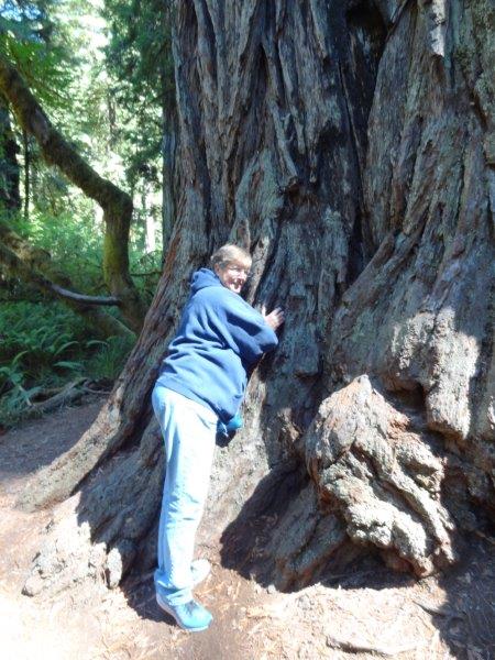
Me…hugging a Redwood for Janelle.
One of the best parts of this visit was the campground we were at. It was called Elk Country RV Resort for a reason. We were in a meadow where elk grazed! In order to stay there, you had to sign a waiver releasing the campground from any liability if you tried to do something stupid like ride an elk.
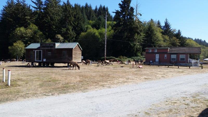
Elk in the campground
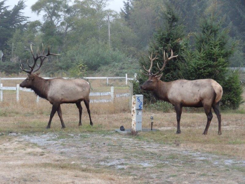
These two elks think campsite 525 is theirs. I think it is!
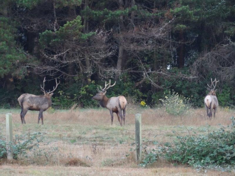
Elks grazing in the morning.
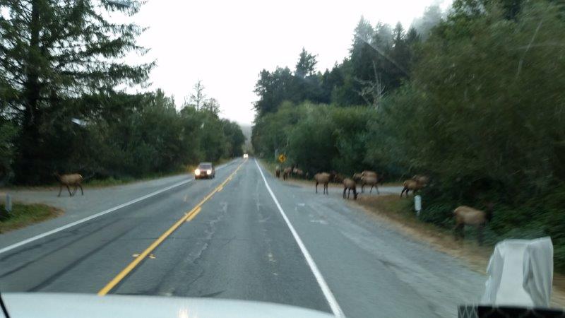
Elks in the road the morning we departed.
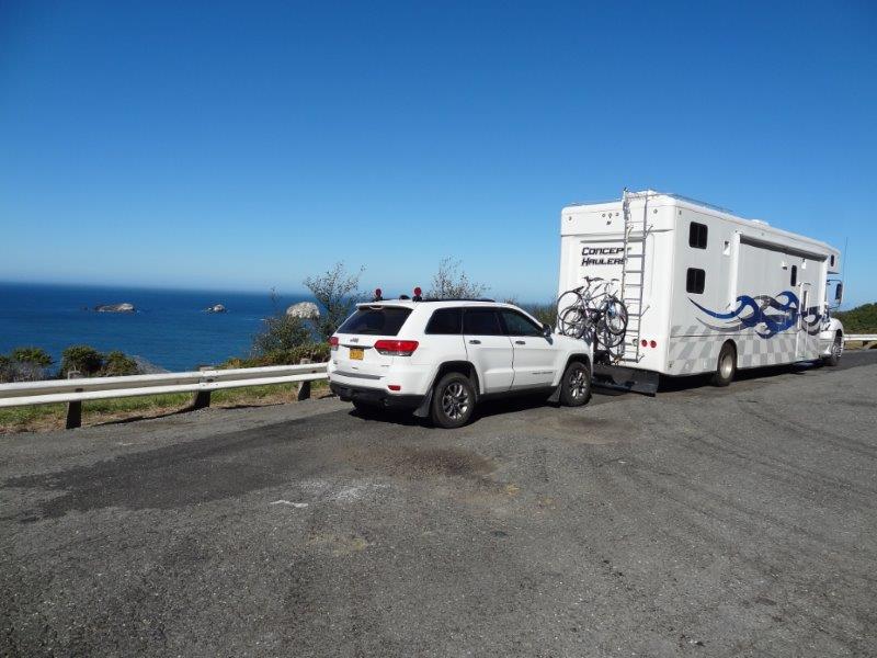
It was time to head north again. Finally, we crossed into Oregon and headed up the Oregon Coast on Highway 101. This is an unbelievable road, the views are outstanding. And the driver of our RV did a stellar job. I’ve never been on U.S. Highway 1 in California, yet. That is the coastal highway you always hear about. It’s hard to imagine it beating this route.
We stopped for lunch, and watched gray whales out the window while we ate.
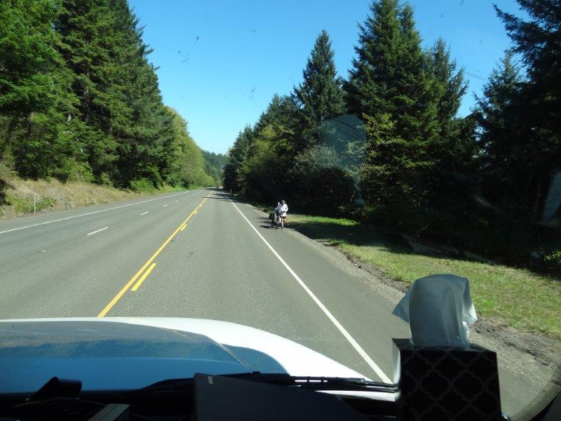
Highway 101 is also the Oregon Coast Bike Trail. A saw a lot of bikes, all heading south. We googled why south and found out this direction gives the bikers a tail wind!
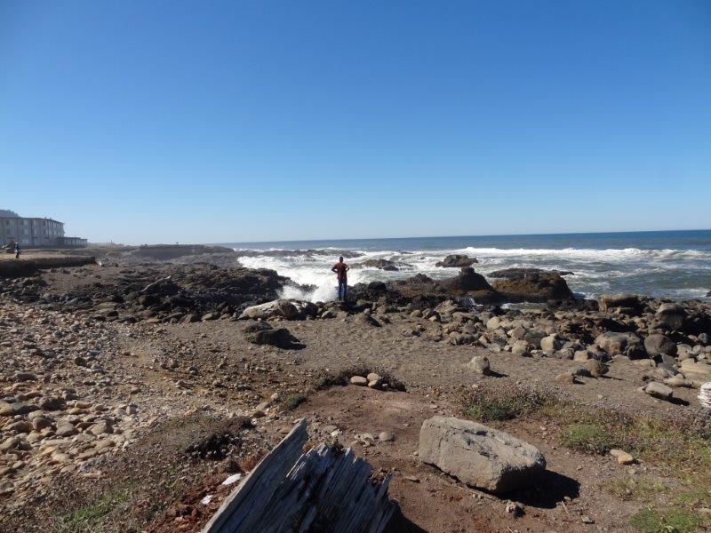
A tourist watching the waves crash.
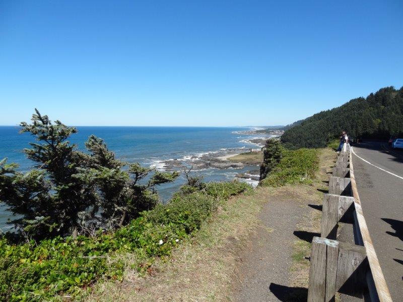
The town of Yachat, Oregon in the distance.
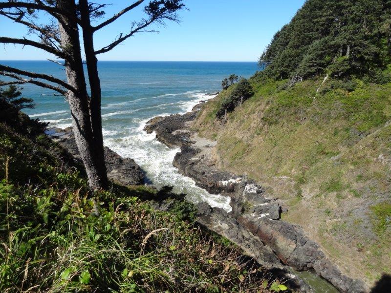
Devil’s Churn – water rushes in and out day after day after day.
We have ended up in Waldport, Oregon. It’s a small town on the Alsea Bay. We scored a dry camping site (i.e. no hook-ups) at a marina for a reduced rate. Since the sun is shining, it’s time to give these solar panels we bought last Spring a proper workout. When the sun went down last night, our lithium batteries were at 100%. But the time we got up, we were at 52%. During that time, we charged electronics, watched TV on a very non-energy efficient 40″ TV, etc. etc. Let see how far we can push these batteries.
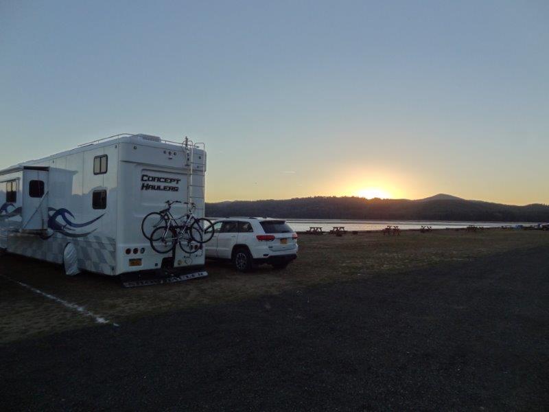
Our camping spot is on the Alsea River. This is sunrise this morning.
Yes, the solar panels are working, but there is a fog rolling in tomorrow. That will render our solar panels almost worthless (we think). So we have decided to head inland. We found a airplane museum we can dry camp at for FREE. So we’ll play tourist, camp for free, and continue to make use of those solar panels.road:
I’ll leave you with a very short 16 second video of waves crashing on the shore. If you can’t view it here, go to https://youtu.be/3LcECkaixUA
What amazing trees. Oregon coast is rugged — at least the part that we saw. Looks like you are still having “fun.”
The Oregon coast is interesting. It is indeed rugged, but there are plenty of sandy beaches interspersed. It is kind of the best of both worlds!
Nice! I’ve been waiting for a full report!
Look closer at the picture of the blimp… it looks like you have a twin barrel gun trained on something out the window- right hand side, a shadow. :0 I know, only i would see something like that.
continue to enjoy the ride!
Twin barrel gun? Only you Mellen, only you.
Very nice. I see some places I would like to check out!