We have been really looking forward to visiting the Canadian Rockies again. Visiting the Canadian Rockies was the first big trip we took in 2014 after buying the Blue Flame. Alas, we weren’t going to get the blue skies and beautiful mountain views that we got in 2014. Why? Wildfires. To be specific, the smoke from wildfires.
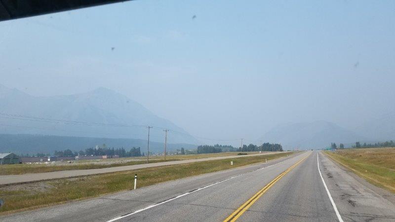
We started really seeing the smoke as we approached the Rockies.
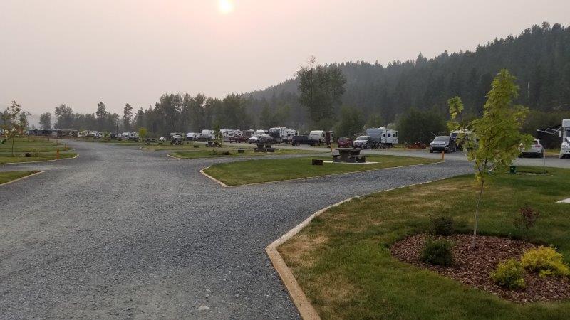
We had four days set aside in Cranbrook, British Columbia to take in the sights. We were lucky if we could see the sun. There ARE mountains out there, you just couldn’t see them. And you didn’t want to be outside in the smoke.
Via the Internet, we had been monitoring road conditions and the wildfire locations . We had been biding our time hoping the smoke would clear out. It was not to be, it was time for us to head out. We decided to take Canadian Highway 3 westward just north of the border.
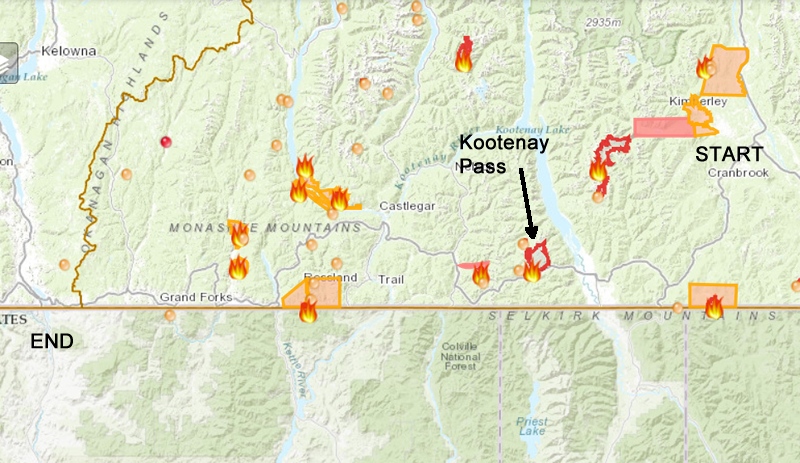
We started from Cranbrook on the right edge of the map, and headed westward on Highway 3 to the border crossing town of Osoyoos. Highway 3 is the gray, curving road. The Kootenay Pass Wildfire was still actively burning. The DriveBC.ca website told us we were down to one lane in that region.
The first order of business was to make sure we had enough fuel for the trip.
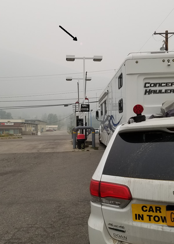
We stopped at a Flying J card lock. A “card lock” is a fueling station you can use ONLY if you have one of their cards. We do. This was around 9:00 in the morning. We could barely see the sun…I gave you an arrow to help you find it!
We headed down the road. What would we find at Kooteney Pass? As we pulled out of the card lock, I did one last check via my phone on the conditions of the road. It was still passable. Join us as we go through the pass. If the video below doesn’t work for you, you can view it at https://youtu.be/E6rtwp4C9Z8.
Let’s just say, I’m glad we are through there safely and don’t really want to repeat the experience. I couldn’t believe the flag people weren’t wearing protective masks. And the authorities must have flag people out there overnight too. That could be a long shift. I give credit to those who fight these wildfires. We never saw any flames, but what we saw and smelled was more than enough.
All in all, it took us 8 hours to make the smokey, stinky trip. The road bent and curved all constantly. Jim had to stay alert driving the whole time. By the time we crossed back into the USA at the Osoyoos, BC – Oroville, Washington border crossing, we were happy to stop at a campground just 2 miles down the road. By the way, US Border Patrol (who DID wear protective masks) took my green bell pepper, tomatoes, and a lime! Who knew?
Today’s air quality is a little better as we sit still and take a down day. The smoke has cleared out some.
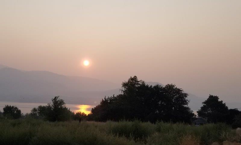
This is a hazy sunrise over Osoyoos Lake as viewed from our campground. Yes, there is still smoke in the air. Yesterday, we couldn’t even see the lake.
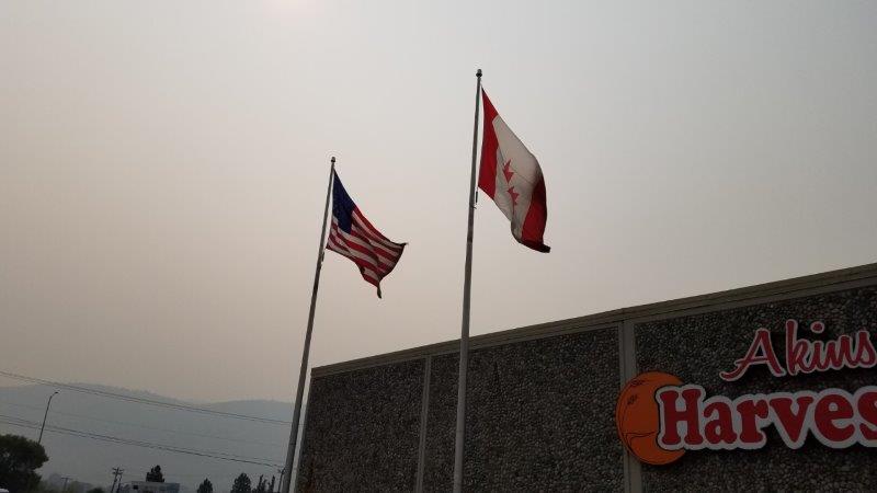
We went out to the grocery store this morning and this is how the American and Canadian flags looked. The edges that flap in the wind are totally coated with soot!
We are heading towards Mt. Rainer National Park tomorrow. Tomorrow (Tuesday) looks to be another smoke filled driving day. But I have hopes for Wednesday.
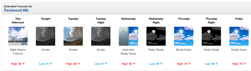
Weather forecast for our next destination.
We’ll have another opportunity to see the Canadian Rockies again, probably when we head to Alaska (someday). But note to self, don’t both visiting a region again if they are having wildfires.
Well — y’all are just having all kinds of experiences — good and bad. Hope you can get out of the smoke soon and smell some nice, clean, fresh air!!!
I have my fingers crossed for favorable winds on Wednesday. We shall see!
My Hero’s
Caution and experience are
Good companions!
Travel safely and snuggle tightly!
Safe travels to you too!