We spent a lovely couple of days exploring the Columbia River Bar. This is where the Columbia River, which divides Washington State from Oregon, exits to the Pacific Ocean. It is a system of bars and shoals, forever shifting. It is where an outgoing river current clashes with incoming ocean waves. The Bar has the reputation of being the Graveyard of the Pacific because it is so difficult to navigate. Seriously.
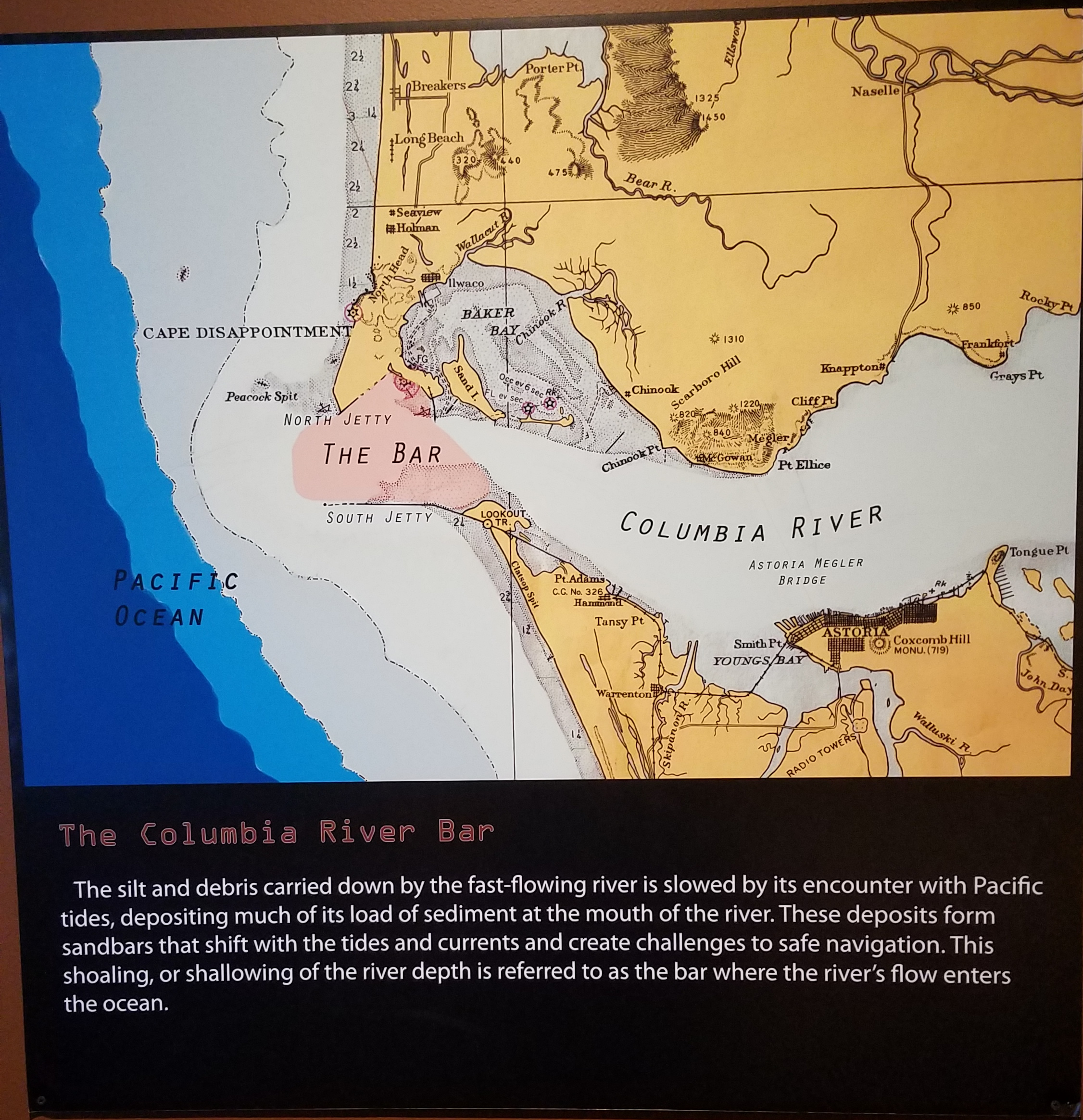
The Columbia River Bar. The Fort Stevens State Park where we stayed was on the point of land that the South Jetty protrudes from. It was a great location to explore from.
Why did we come to the Columbia River Bar? It stared with a podcast I listen to, Make Me Smart. The hosts interviewed Captain Deborah Dempsey, a bad-ass Columbia Bar Pilot, Retired. She talked about what it takes to navigate the Bar as a Bar Pilot, bringing in ships safely to the Columbia River. It was quite interesting to say the least and totally intrigued me. If you are interested in listening to the podcast, I’ve linked to it below. Use your mouse to advance to 5:00 for the hosts’ intro to the interview. The Interview itself goes from 8:40 to 21:10 (12 minutes long). OR, scroll down for a shorter alternative.
If you listened to the that podcast is why we traveled to Astoria, Oregon and the Columbia River Bar. Alternatively, you can watch the video below which I found after our visit and also features Captain Deborah Dempsey. At 2 minutes, it’s much shorter than the podcast interview. You can also see the video at https://youtu.be/nb_mBNfS-A8.
So that’s why we decided to visit the Bar and Astoria, the town just east of the Bar. We wanted to see the Bar and Bar Pilots. I could put in lots of words about how the Bar Pilots work, but I think the video did it justice. One cavate…the Bar Pilots usually get on ships via helicopters these days.
The Bar
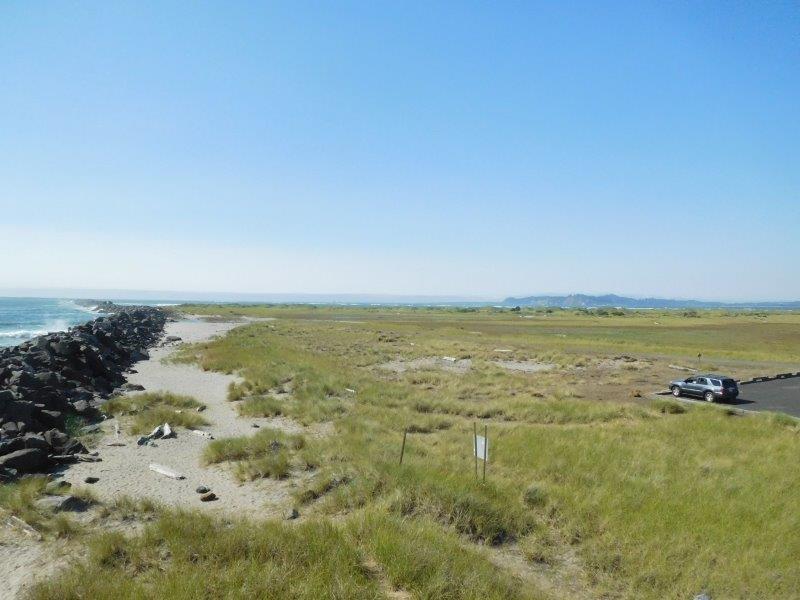
This is the South Jetty on the south side of the Bar. This is as close as we could get to the bar, short of renting a boat and probably killing ourselves.
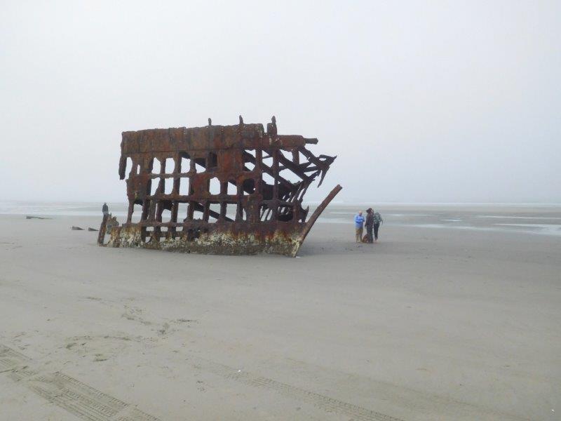
Within Fort Stevens State Park where we camped, one of the beaches has what is left of the ship Peter Iredale. It ran aground in 1906.
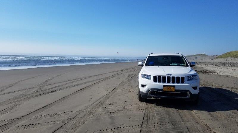
The state park gives you full access to the beaches via vehicle before noon. So, let’s take the Jeep to the beach!
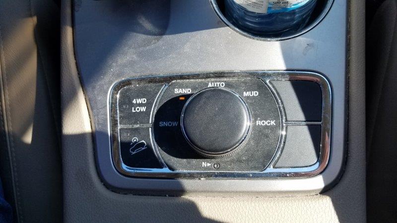
We bought this Jeep because of the ease of towing it behind the RV. Never did we realize that we would get use out of the various four wheel drive modes, like SAND. We got a whopping 3 miles to the gallon while in SAND mode. It was almost impossible to get across the sand without it. Excuse the dust. The Jeep hasn’t been cleaned since we were on those dusty roads on Manitoulin Island. A thorough cleaning is on the to-do list.
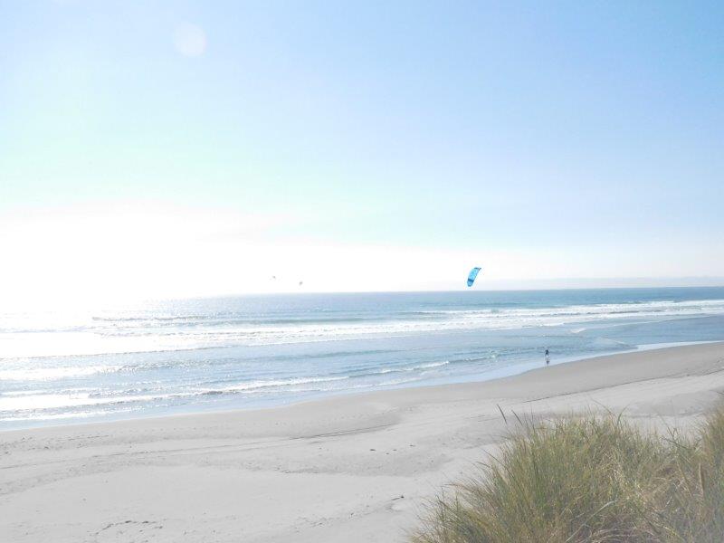
While at the beach, we saw a bunch of people kitesurfing. Surfboard + Kite = Kitesurfing
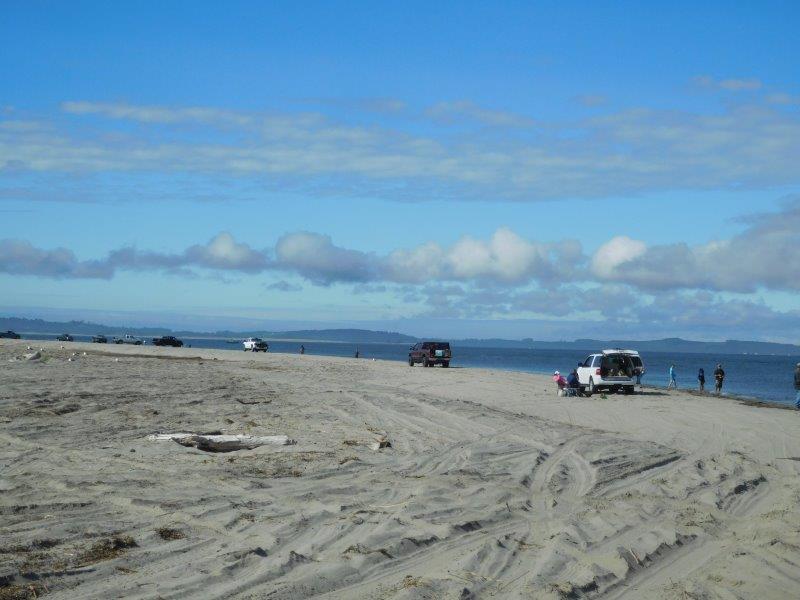
The very southeastern edge of the Bar is a popular fishing spot.
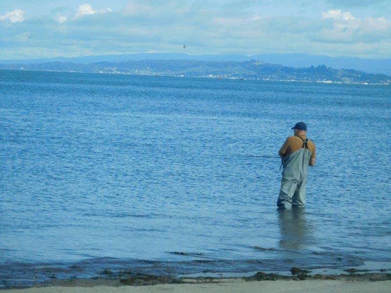
Before this gentleman waded in, I had the opportunity to quiz him. They are fishing for salmon. Pink lures work the best. Stay 25 yards away from your neighbor. People show up at 4:00 a.m. to get their favorite spots in the morning. No thanks, I’m still sleeping then. Still, it would be fun to do some fishing!
Coast Guard
This area also is home to the Coast Guard Air Station Astoria. It wasn’t hard to spot the Coast Guard’s presence.
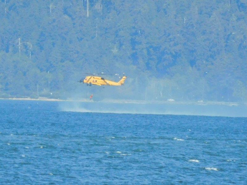
While we were watching people fish, we spotted this Coast Guard helicopter out over the river. They were practicing retrieving people from the river.
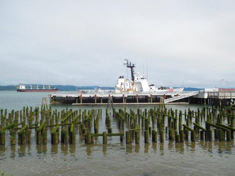
Docked in the town of Astoria is a Coast Guard Cutter. The town used to be totally on piers over the water, not so much any more. But a lot of the pier uprights remain.
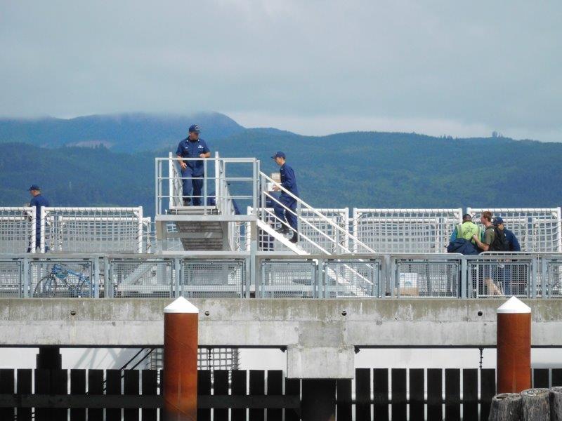
It apparently was reprovisioning day on the cutter. We heard a call over the cutter’s loudspeaker calling all hands to the dock to bring on board all the crates being delivered by a Sysco Foods truck.
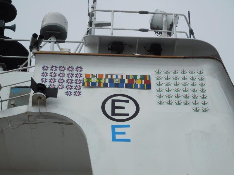
Later we got closer to the Coast Guard Cutter and spotted this on the side. The leaves on the right side were obvious – the number of marijuana seizures made. But the snowflakes on the left had us stumped. I asked one of the Coast Guard personnel in the area what they represented. Cocaine seizures! Who knew?
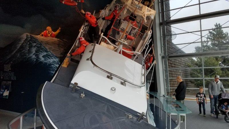
This is an actual retired Coast Guard Lifeboat on display showing what a rescue in rough waters would look like (the man overboard is on the left). All the Guardsmen have on foul weather suits and are tethered to the boat. The Guardsman at the helm is strapped into his chair. The Lifeboat is designed to right itself if it capsizes. This picture doesn’t do justice to the angle that the boat is at in these “rough seas.” I got seasick just looking at it.
River Pilots
Just like the Columbia River Bar has pilots to bring ships over the Bar, ships also take on river pilots to take them down the Columbia River.
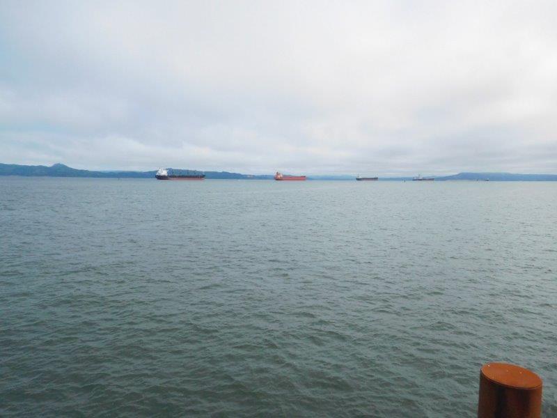
At any time, you can find ships anchored in a wide portion of the river off Astoria. We found a knowledgeable local who explained why they are even there. The ships are waiting to go upriver to their destinations (anywhere from Portland, Oregon all the way east to Lewiston, Idaho). But they can’t go until there is room for them in their destination port. So the ships anchor here because 1) there is no anchorage fee and 2) there is room for the boat to swing around so only one anchor is needed. If they were further upriver, they would have to pay to anchor AND have to put two anchors down. It’s like us parking at a Walmart for the night in the RV!
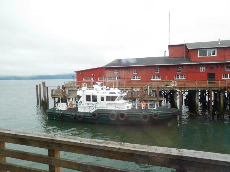
We found the River Pilot’s boat docked in Astoria.
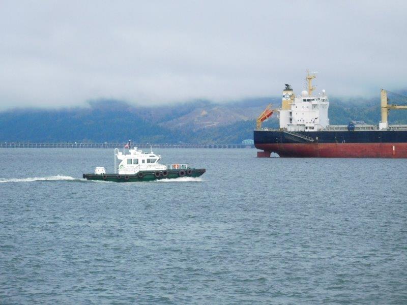
We also waited around long enough to see the pilot boat take a river pilot to a waiting ship.
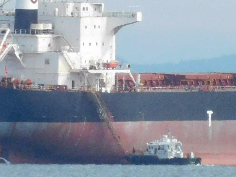
I did my best with my 20x optical zoom on my camera to capture a pilot going up the ladder. Shortly after the pilot was onboard, it departed. Jim checked later on MarineTraffic.com and found the ship was headed to load up with grain in Portland.
Astoria
Let’s not forget the town of Astoria. We spent some time exploring there.
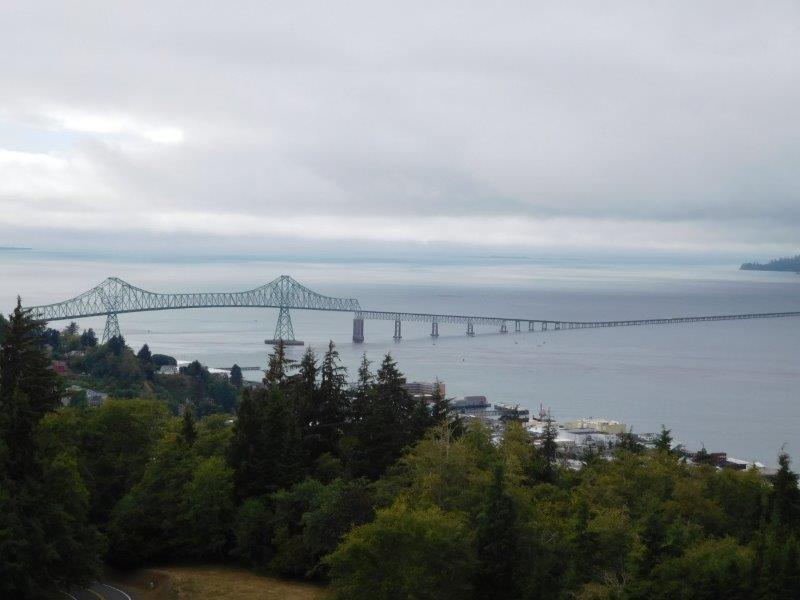
This is the Astoria-Mengler Bridge, connecting Astoria, Oregon to Washington.
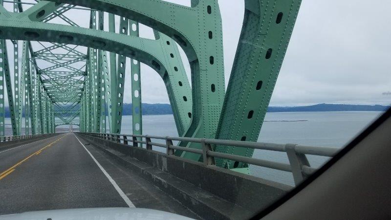
Yes, we drove over it and back…because we could!
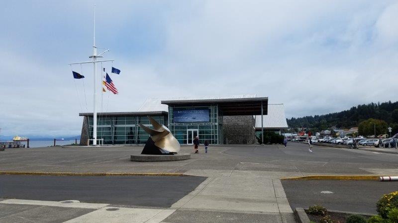
Astoria is home to the Columbia River Maritime Museum. It is VERY MUCH worth the price of admission. They have displays about the pilots, Coast Guard, and even a fisherman’s boat that washed ashore in the area as a result of the 2011 tsunami that hit Japan.
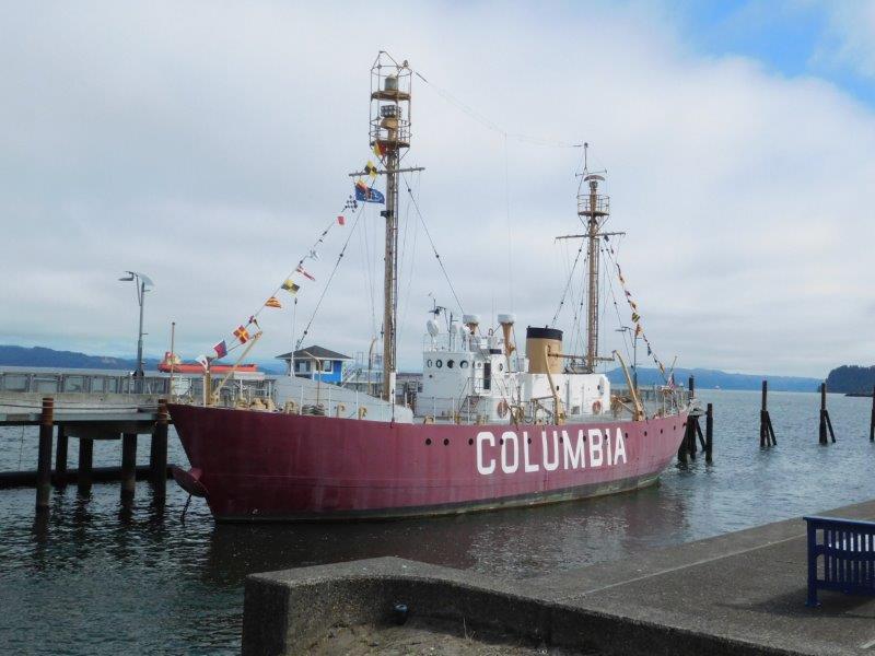
Museum entry included getting onboard the Lightship Columbia. The mast on the left has a light at the top to warn passing ships. For 86 years, a Lightship was anchored off the Bar. This ship served from 1951 – 1979 when a buoy then replaced it. Can you imagine being on this ship 24 x 7, anchored, weathering all sorts of storms? No, I can’t either.
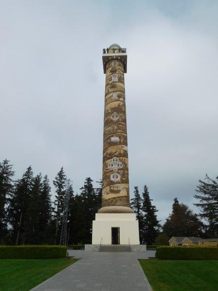
This is the Astoria Tower. Overlooking the town, this tower recalls the history of the area (including Lewis and Clark spending a winter here). I took the picture of the bridge from this vantage point.
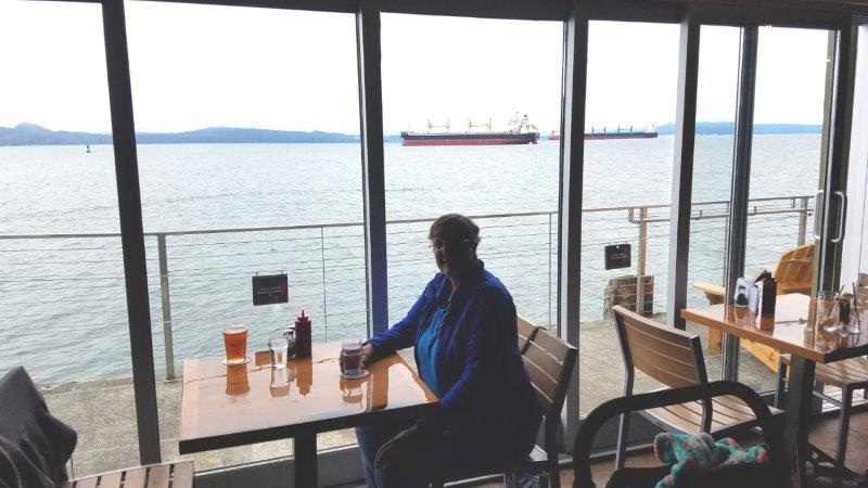
Finally, let’s get some food. We found a microbrewery with a river view. The place was built on a pier over the water. It also had a very unique feature (other than me).
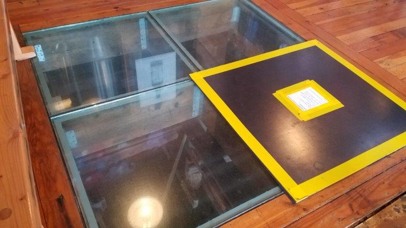
There are windows in the floor to view the sea lions under the pier! Wait…what’s that yellow sign about?
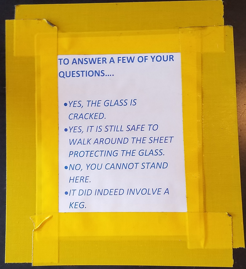
I’m sure there is a story behind this sign at the microbrewery!
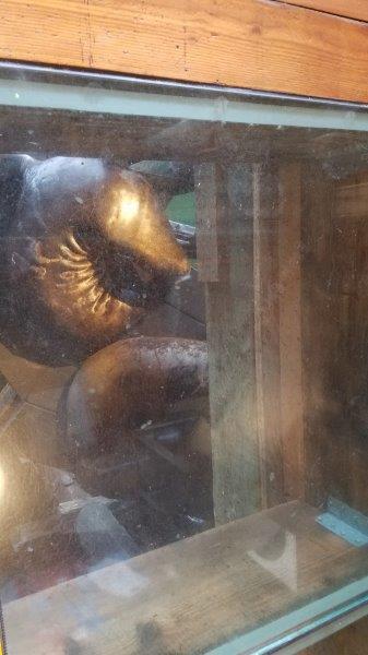
Anyway, there are indeed sea lions below!
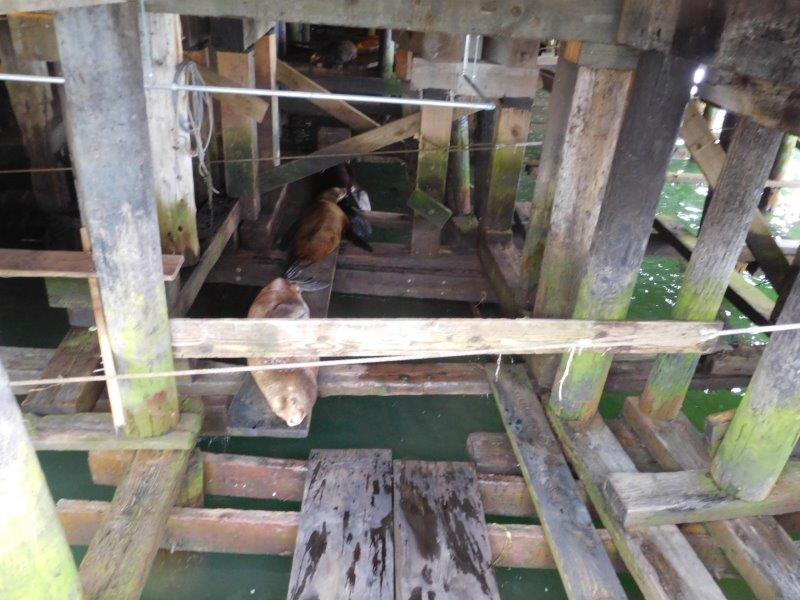
A walk around the outside of the buildings showed exactly what is happening under those piers! Planks have been provided for the sea lions (and the tourists). You could hear sea lions barking all up and down the walk along the river.
We thoroughly enjoyed our visit to the Columbia River Bar. In typical fashion, we ignored all the trendy stores and tourist traps. Instead, we focused on the unusual and interesting to us. It was a great time. And we can now say that in 2018 we have camped on both the Atlantic and Pacific coasts!
Wow — lots of interesting “stuff.” Thanks for sharing!!!! How long is that bridge?
To borrow from Wikipedia:
Opened 52 years ago in 1966, it is the longest continuous truss bridge in North America. Located fourteen miles (23 km) from the mouth of the river at the Pacific Ocean, the bridge is 4.067 miles (6.55 km) in length, and was the final segment of U.S. Route 101 to be completed between Olympia, Washington, and Los Angeles, California.