We made our way from Seward back to Anchorage to drop Janelle off at the airport for her return to the East Coast. Since we were back in a major city, we spent a couple of days refreshing our tanks and getting groceries, etc. Then it was back to the Kenai Peninsula to see when else it held for us. Our next destination…Homer.
Homer has almost a mythical aura about it in RVing circles. You always hear about the Homer Spit and how it is “THE PLACE” to be on July 4th.
spit /spĭt/ noun – A narrow point of land extending into a body of water.
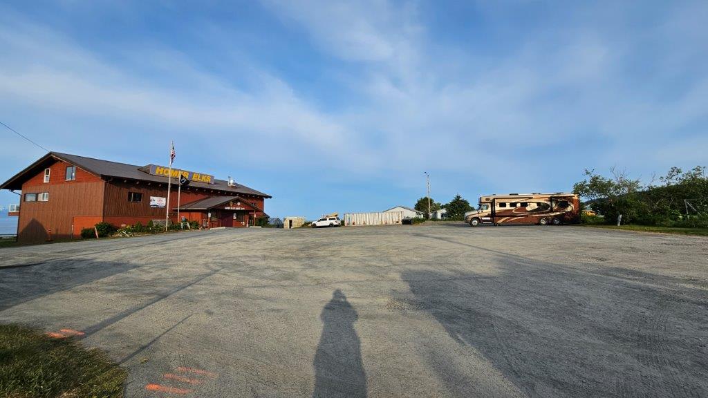
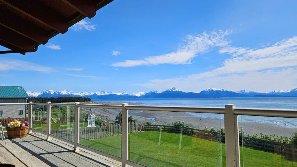
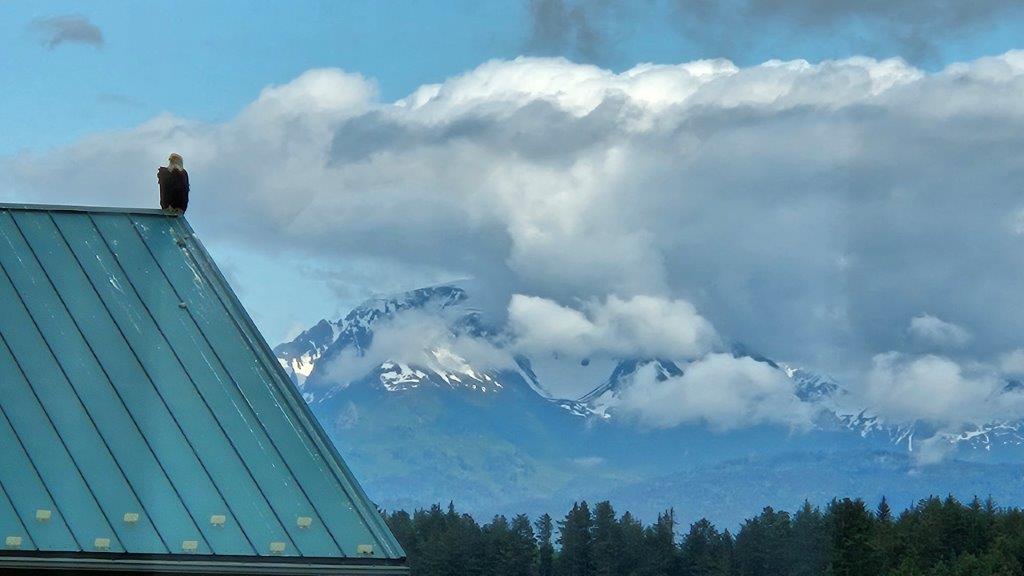
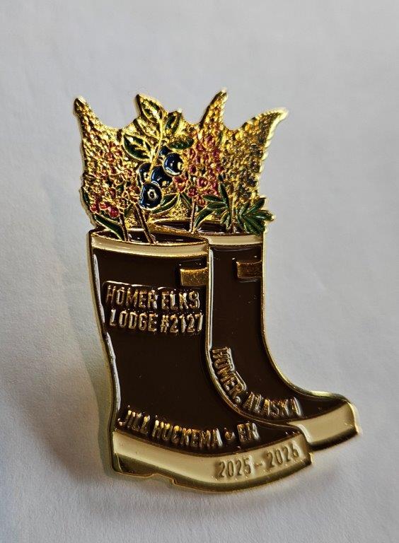
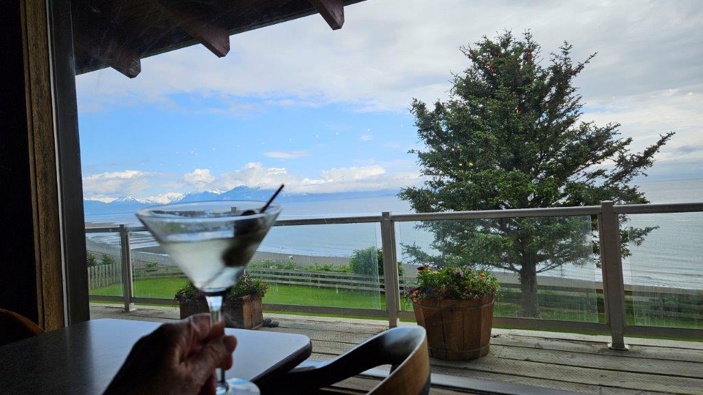
The Homer Spit is a 4.5 mile long strip of land sticking out into Kachemak Bay. The Spit has a number of basic campgrounds, tourist shops, restaurants, and the Homer Boat Harbor. Camping on the Spit is supposed to be a wild experience if you can get a reservation and are into chaos. We didn’t have a reservation and our chaotic days are behind us. Thus, we opted to stay at the Elks Lodge instead. And we are VERY GLAD we did.This is the Homer Elks. They have eight RV spots with 30 amp power and we had the whole place to ourselves most nights.The Elks Lodge is right on Kachemak Bay and has an outdoor balcony that we could access anytime we wanted. Yes, this would do nicely.When we were in the Lodge the first evening, one of the local members said “Look, there’s a bald eagle on the building next door.” Yes! Another eagle sighting. Turns out, it would be the first of many.Elk Lodge leaders (called Exalted Rulers or ERs) typically have lapel pins to hand out during their tenure. I spotted a member wearing this pin and absolutely loved. It featured Xtratuf boots (if these boots aren’t the official state footwear of Alaska, they should be) with lupine, fireweed, and blueberries spilling out of the top of the boots. Apparently the ER heard I was admiring the pin and later that evening she knocked on the RV door and handed us two of them. What a nice surprise.
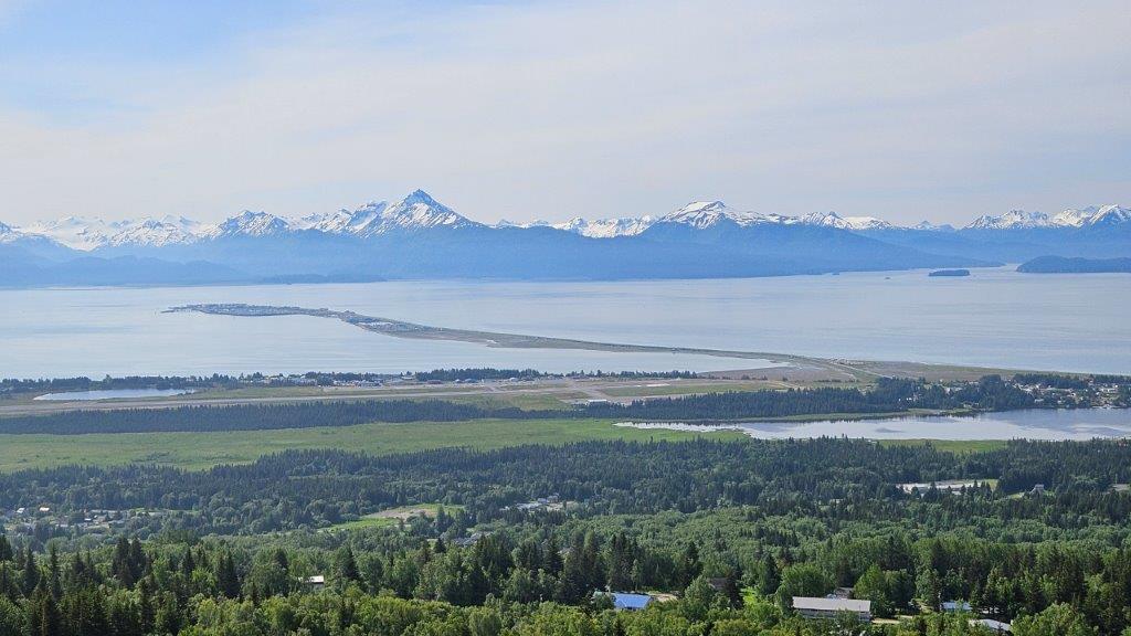
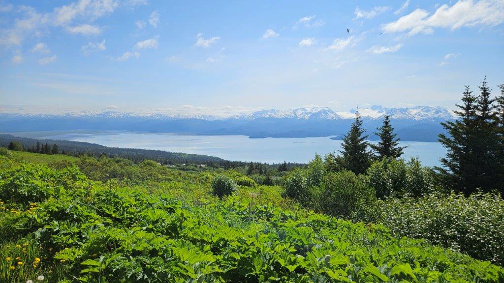
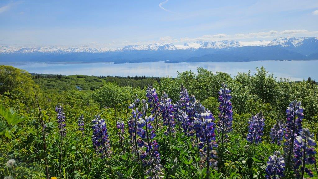
Skyline Drive
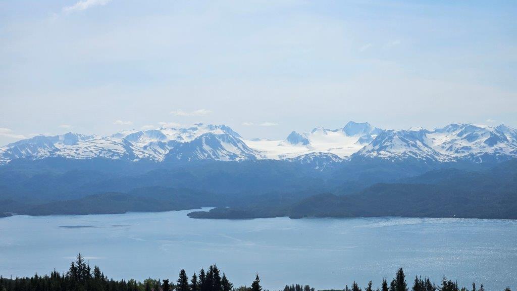
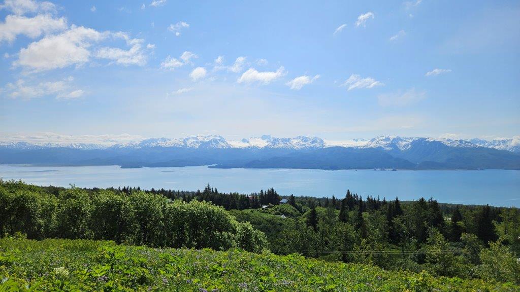
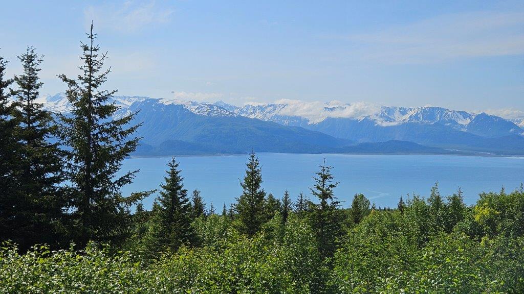
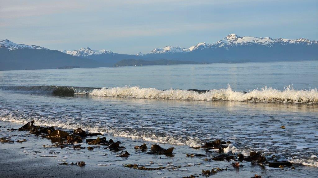
Our first full day, we decided to check out the surrounding areas. Across the bay from Homer is the other side of Kenai Fjords National Park with it’s multitude of peaks and glaciers. We took the highest road out of Homer just to see how it all looked. WOW!!!!
There wasn’t a bad view from any place. James and I both said that IF we wanted a summer home somewhere, this would be the place to be. Get a house up high and you could have views like this everyday. Pictures don’t do this scenery justice.
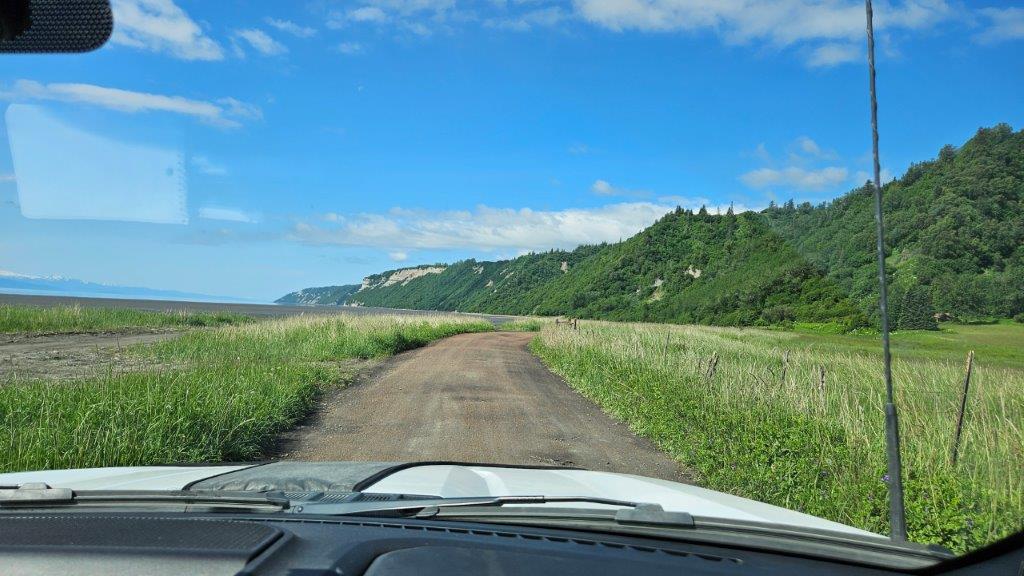
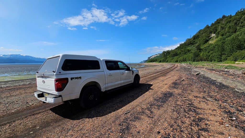
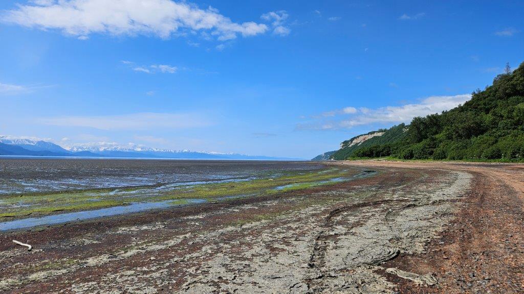
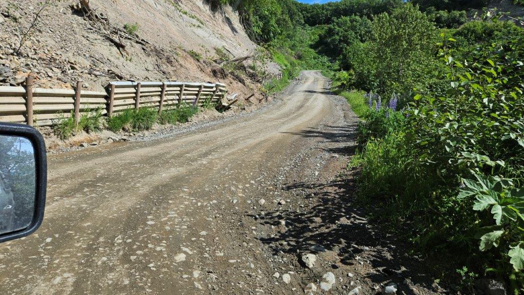
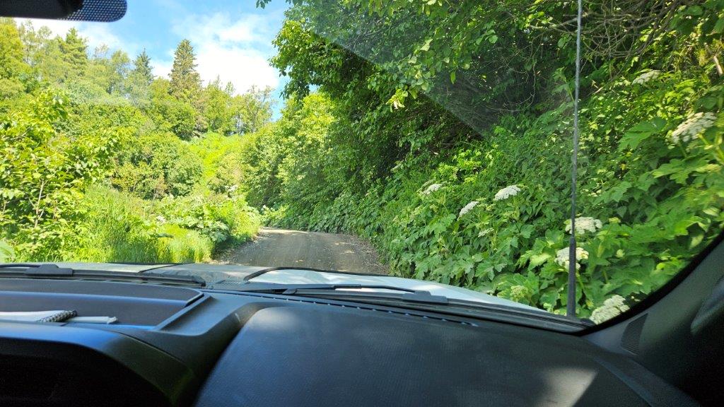
From there, we decided to drive the road westward out of town as far as it would take us until we ran out of road. We found ourselves down at the edge of the bay on a one lane, dirt path.
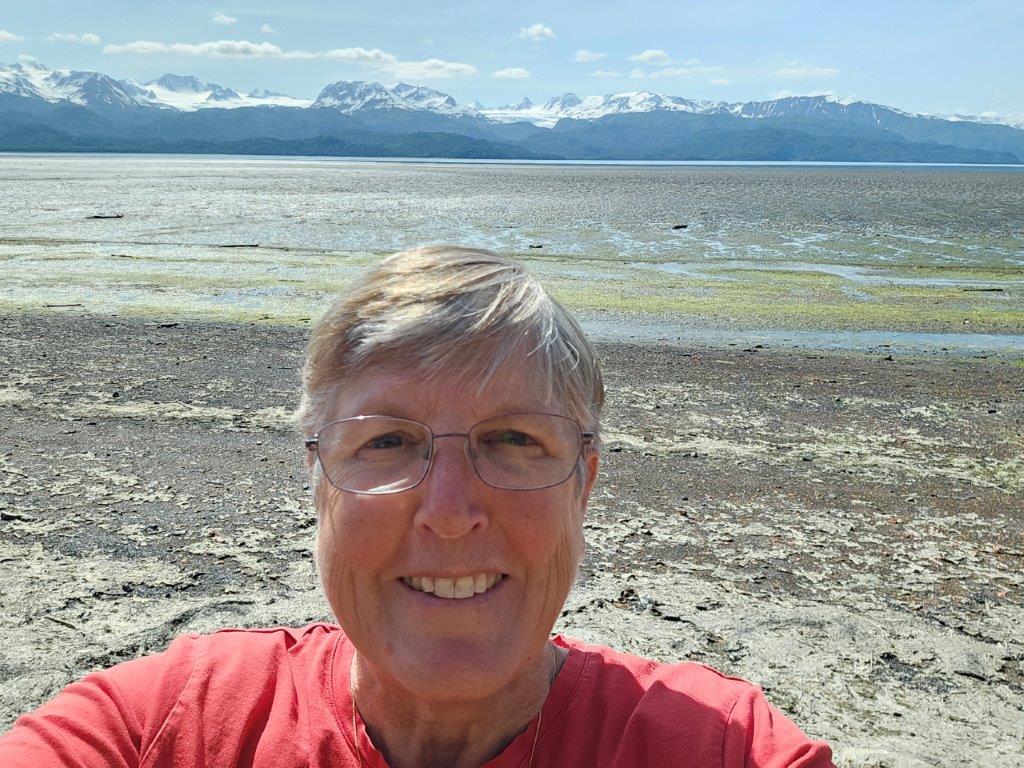
Are we even supposed to be here?And there we were, on the mud flats at low tide. Mind you, our new truck didn’t even have 2000 miles on it yet at this point. “Yikes” is what I said. James was having a 4 wheeling blast.Low tide in Kachemak Bay.OK…I admit it, it was pretty cool to be out here.What comes down must go up, right?I just hoped we didn’t come across another car on this little excursion. Every so often, we would see a driveway and accompanying house. If you need a gallon of milk, you don’t just pop out and get it! We couldn’t believe people lived wayyyyy out here.
We finally got back up to the top with minimal mud on the truck. Phew.
Lupine and five dormant, glacier covered, volcanoes.
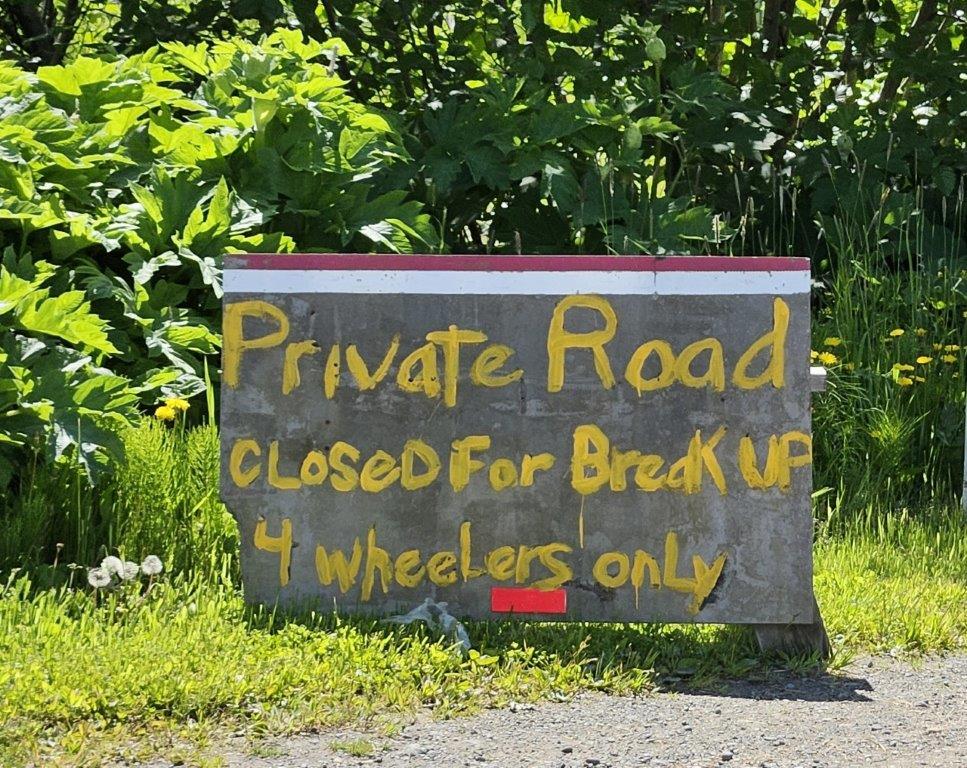
I found this sign amusing along the road. “Closed for Break Up”???? Whose break up? No, not that kind of break up.
Break up refers to the process of ice literally “breaking up” and snow melting and turning to slush. Ice melts on the rivers and starts breaking away into pieces. Break up is long since done for this year. I think they can remove the sign now.
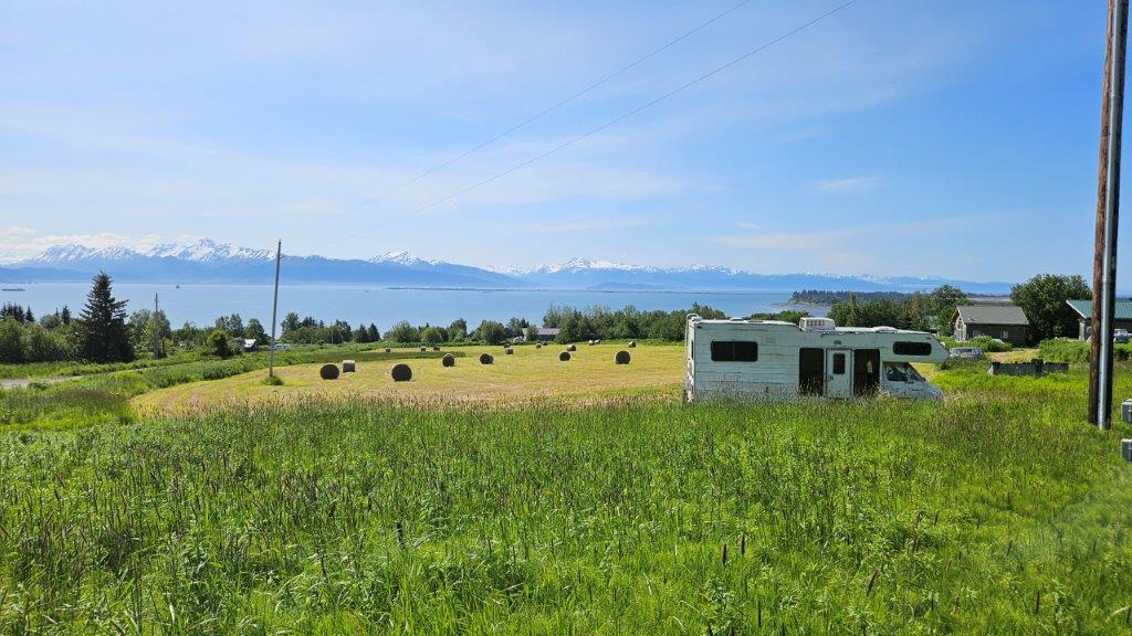
We found the sight of hay bales interesting. It has to be a short growing season. And what do they use the hay for? We didn’t see any cows, but we did see horses here and there.
Anchor Point
Our next destination was the little community of Anchor Point. Anchor Point is the western most piece of land in North American that you can access by car. Really! Ironically, last summer we were in the eastern most point in the USA (Lubec, Maine). Coast to coast baby!
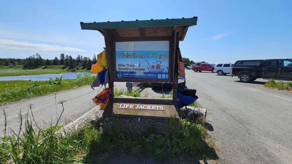
Anyplace there is water, there is a kiosk where you can borrow for FREE, life jackets for little ones. Nice. Keep those kids safe.
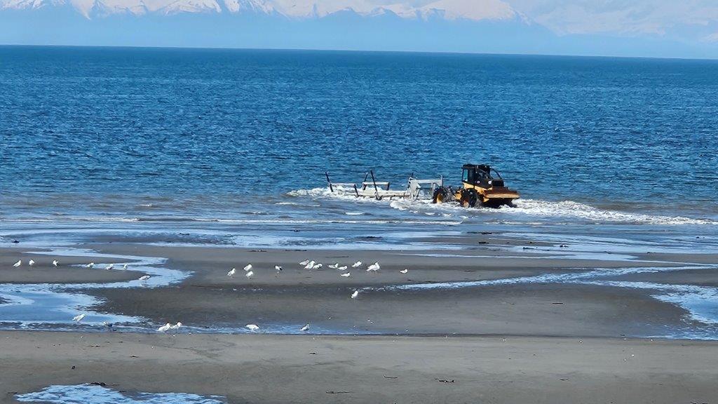
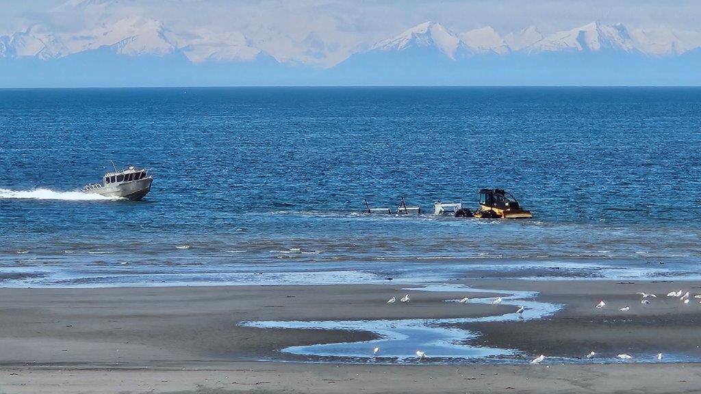
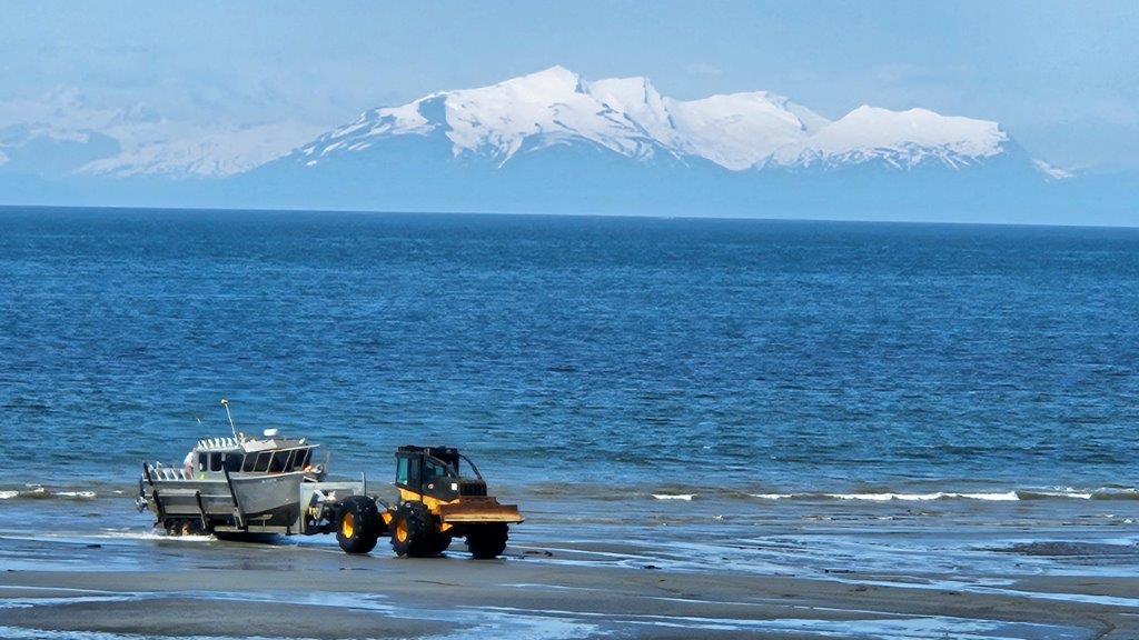
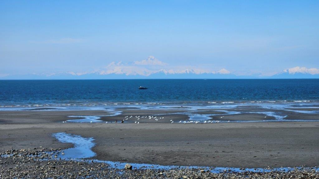
Anchor Point Beach is a popular spot from which to launch your fishing boat. But there isn’t a traditional boat launch, especially considering how big the tides are. But there is a road of sorts down to the beach. One enterprising company will put in/take out your boat for you in a unique manner for $80 (according to the Internet). Let’s get out the heavy machinery!
This is a log skidder (according to James) with an empty boat trailer. He’s backing into the water.Into the water he goes. The salt water must do a number on the metal on that piece of equipment! And here comes the boat!The boat propels itself up onto the trailer and a poor guy (with waders) jumps into the cold water to hook the boat to the trailer. And zoom, they haul the boat and trailer back up to the parking lot on the upper level. Amazing. We watched this process for a good hour, it was so entertaining.
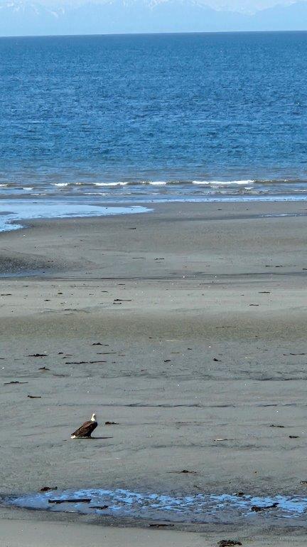
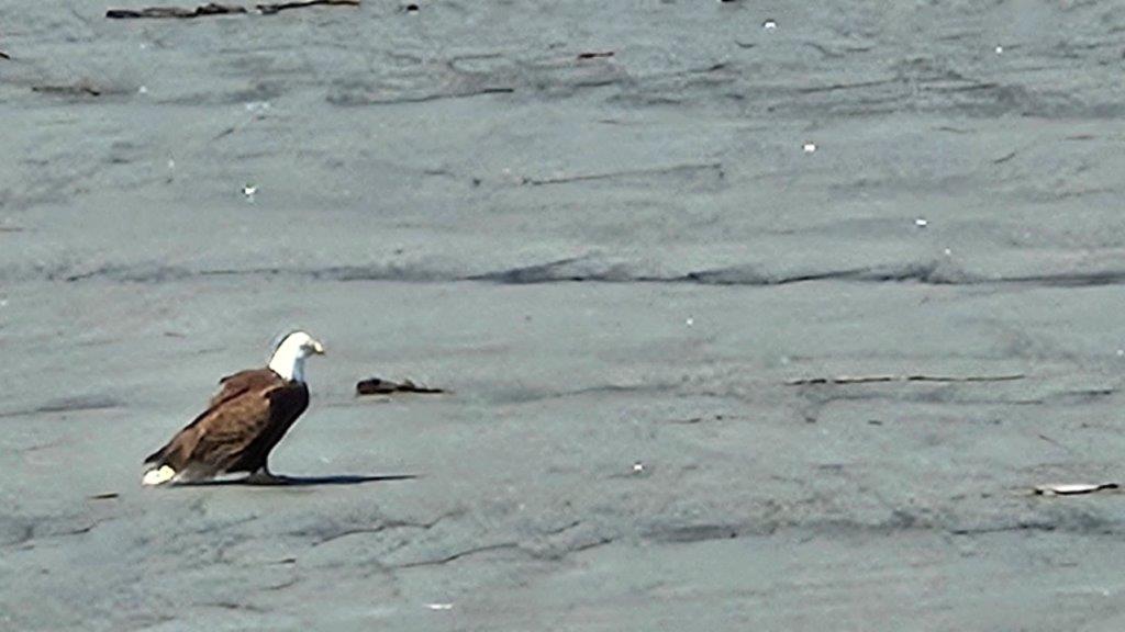
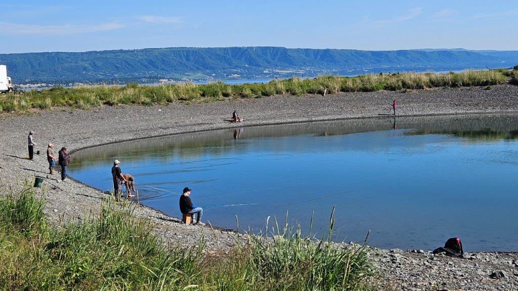
This particular section of beach must have had a bunch of dead salmon on it (we didn’t get close enough to verify). The sea gulls and BALD EAGLES were having a feast. Once again, if only I had a long lens camera.
This guy was just chilling by himself.
From our vantage point, you could see the gulls and eagles hanging out together. I counted 17 bald eagles on the beach at one time.
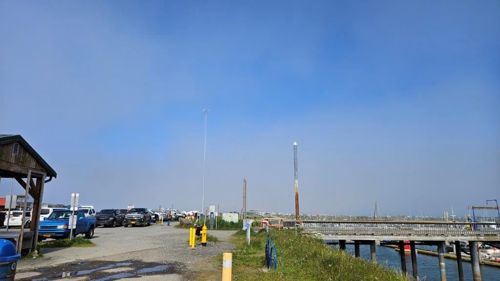
Homer Spit
It was time to explore the Spit itself. We had already made one quick trip down the Spit in the truck to get dinner one day. It was time to do a proper exploration.
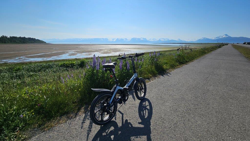
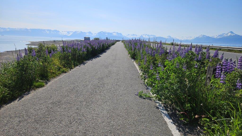
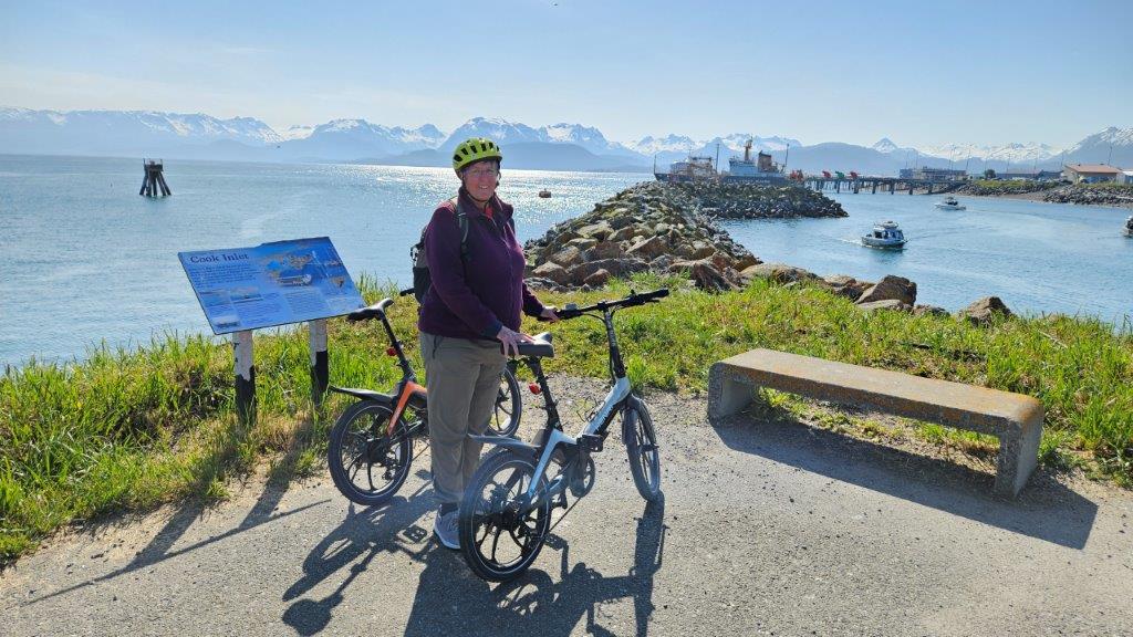
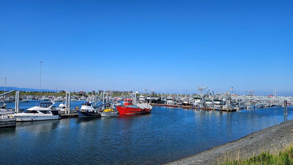
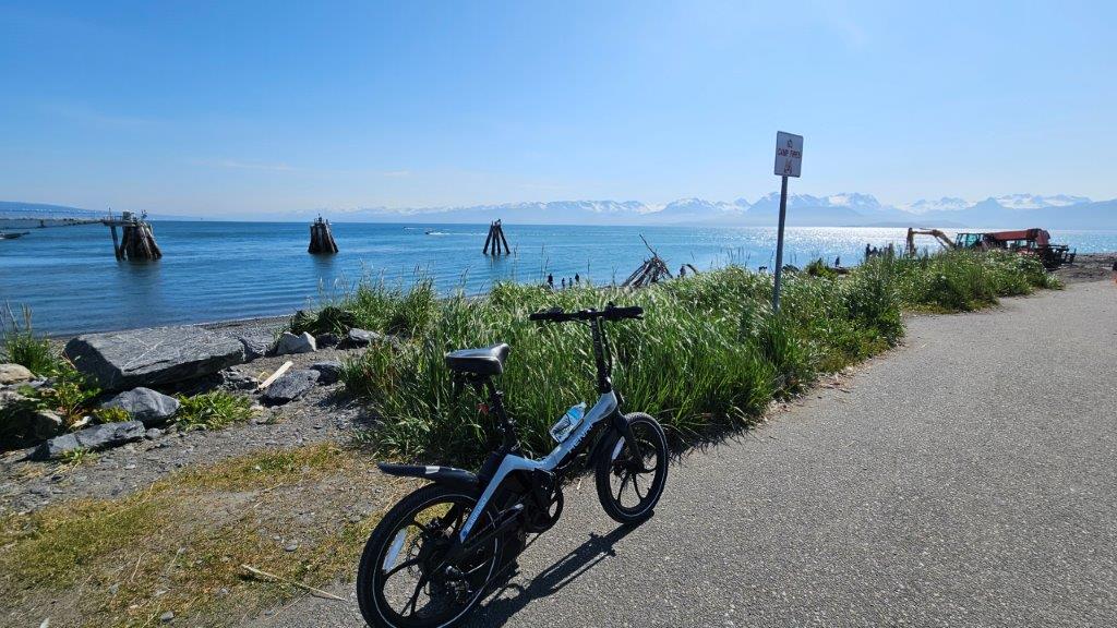
It was time to get the eBikes out again. There was a paved bike path the 4.5 mile length of the Spit. Woohoo! That’s my kind of riding.This mental image will forever be in my mind. Here I was, riding down a lupine lined path with glaciers and mountains in the distance. Life is VERY good.At one point along the Spit pathway, we found this fishing hole that is stocked with salmon. We watched for a bit and found the fisher-people where “tight lining” for fish. We only knew this because a local explained what was happening. The fisher-people looked like they had fly fishing rods. They would cast into the water and immediately pull the line back in. They were hoping for the salmon in the water to bite the line. Jerking the line back quickly would cause the line to slip through the fish’s jaws. Once the end of the line was reached, a hook at the end of the line would snag the fish. Personally, after seeing something like this, I appreciate being at the top of the food chain.We rode all the way to the end of the Spit. My knees enjoy having battery power (on the bike…not in my knees).The harbor, full of fishing boats. Salmon season is just ramping up.Time to head back.As we turned around to return the 4.5 miles, a cold fog rolled in over the Spit. Let’s just say I got the opportunity to try out the highest battery setting (speediest) on my eBike. We definitely got back quicker than we got out to the end of the Spit. We were a tad chilly by the time we got back to the truck. But the ride was still worth it.
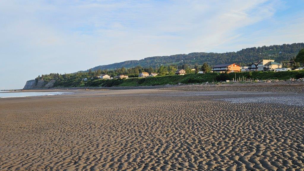
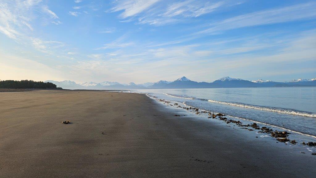
Bay beach walk
Another day, it was low tide when we got up. It was time to check out the beach.
The reddish brown building in the sunlight on the right is the Elks Lodge. Yes, we really, really enjoyed our stay there.
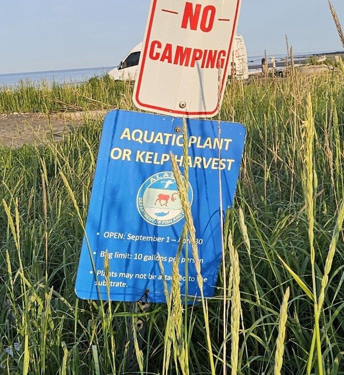
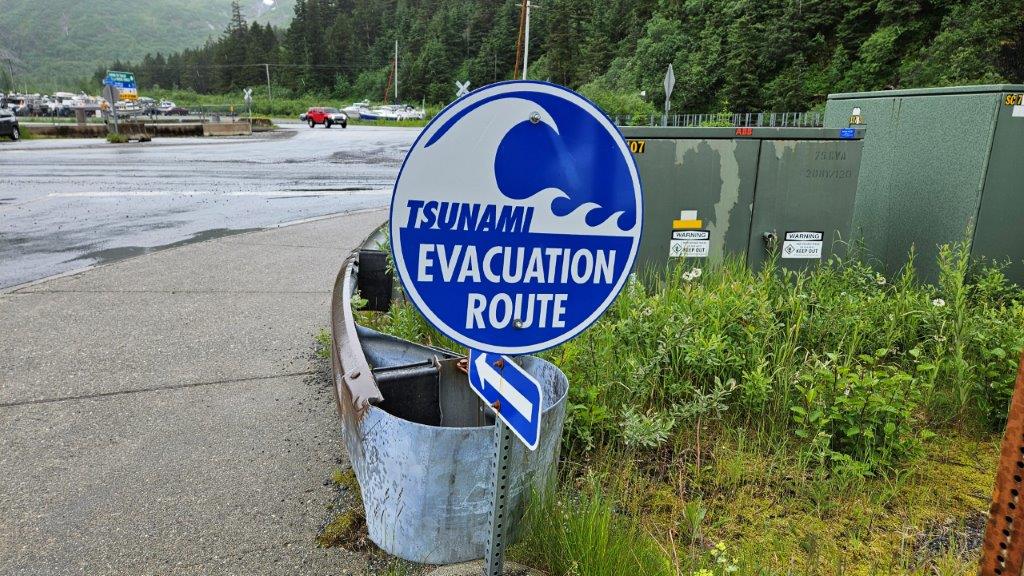
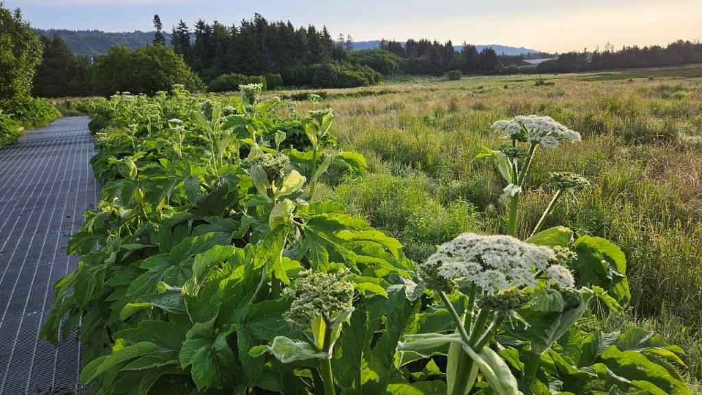
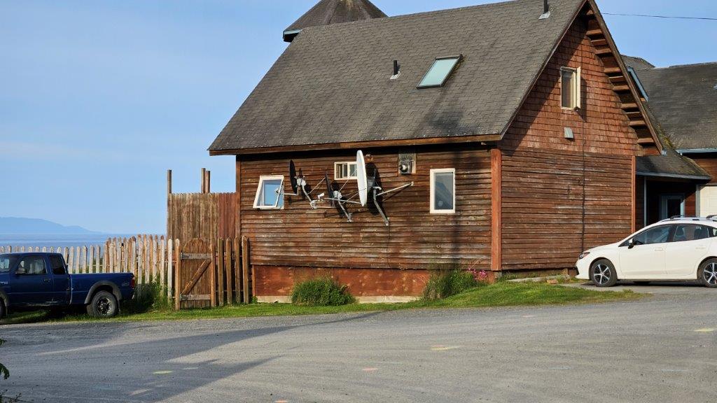
Kelp Harvest? 10 gallons per person? September 1 to April 10? Interesting. I did see kelp on a menu during our stay. No, I was not inclined to try it.That tower is a tsunami warning siren.We saw these signs in every coastal town we were in.There was a board walk in the salt marsh next to the beach. Cow Parsnips were everywhere! The look a bit like oversized Queen Anne’s Lace. But not big enough to be Hogweed.For those of us from the lower 48, this is not what one thinks of when you picture a television satellite dish on a house. Usually the dishes are pointed way high up into the sky. Not in Alaska, they are pretty much pointing at the horizon because all the satellites are to the south. In fact SirusXM Radio won’t work in most of Alaska north of Juneau, there just aren’t satellites visible due to the curvature of the Earth.
Summer Solstice
We had been making noise about being at the Arctic Circle on the Summer Solstice, June 20. However, with the way our destinations with Janelle got flipped around (due to weather) and us needing to be at an RV Rally in Denali State Park over the July 4th holiday, it didn’t make sense for us to drive the Parks Highway northward yet another time. It’s a lot of miles and fuel. So we stayed where we were…in the south. The Arctic Circle and Arctic Ocean are still on our agenda. It just won’t coincide with the Summer Solstice. We spent the Solstice in Homer instead. Not a hardship.
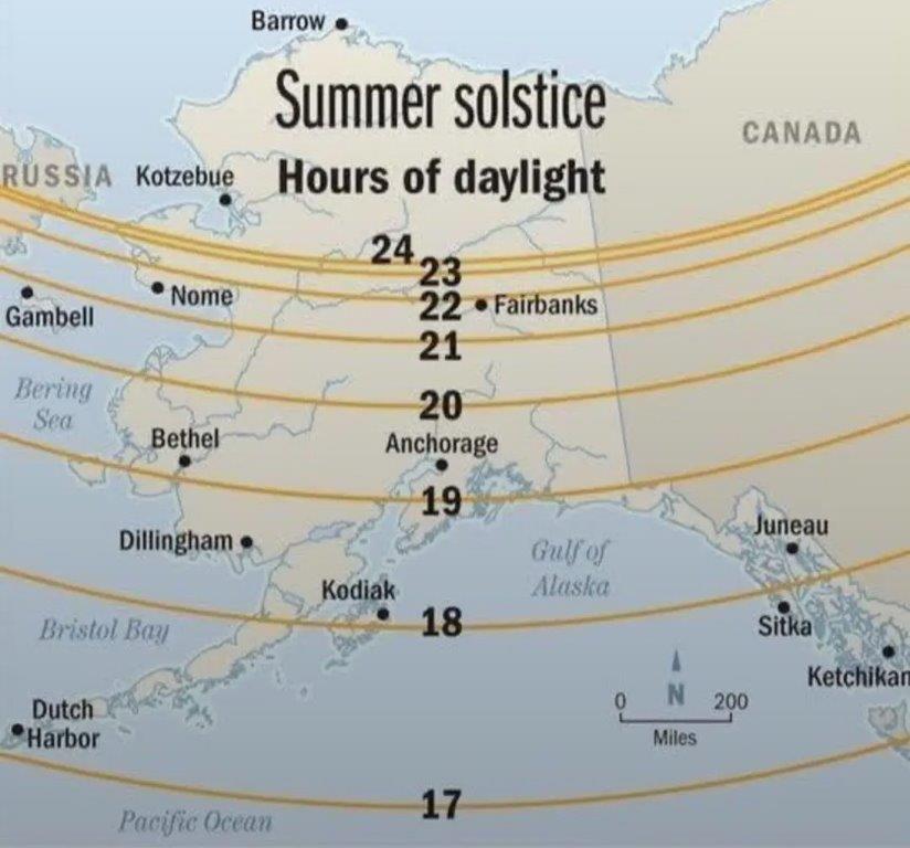
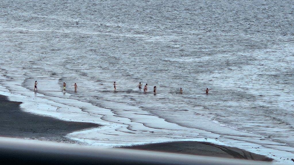
I tripped over this graphic on the Internet. Instead of 24 hours of daylight on the Summer Solstice, we’ll only have 19. It’s not really a big deal, we’ll still go to bed before sunset and get up after sunrise.While in the Elks Lodge the evening of the Summer Solstice, we spotted these crazy people doing a polar plunge into the Bay. The water temperature in the bay was reported as being 49 degrees Fahrenheit. Brrrr. I guess that’s one way to celebrate the start of Summer.We preferred to celebrate from inside the warm Lodge.
I don’t know if anyone else commented, but Homer is actually a famous cable tv town. There was a show called “Alaska, The Last Frontier” about the Kilcher family (aired 2011-2022). The family’s ancestors came from Switzerland in the 1940s and the family continues to live off the grid on the family’s 600+ acres.

I don’t know if anyone else commented, but Homer is actually a famous cable tv town. There was a show called “Alaska, The Last Frontier” about the Kilcher family (aired 2011-2022). The family’s ancestors came from Switzerland in the 1940s and the family continues to live off the grid on the family’s 600+ acres.
I did not know that. I’ll have to check it out.