Big Bend National park is AWESOME! This is another example of a park that we didn’t know much about and didn’t quite know what to expect (another instance being Death Valley). We managed to get a week’s reservation at Big Bend and have thoroughly enjoyed it.
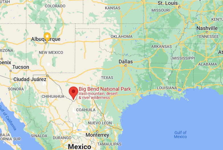
For those who aren’t aware, Big Bend is in the west of Texas, with its southern border being the Rio Grande River with Mexico on the other side.
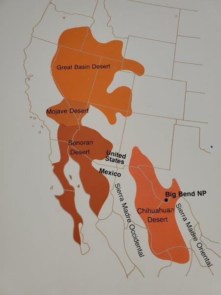
There are four deserts in the United States. Big Bend is located in one of them, the Chihuahauan Desert. (And we can say we have been in all four!)
Accommodations
Campground reservations here are notoriously hard to get within Big Bend National Park, with peak season being November thru April. There are only two campgrounds that can accommodate an RV as big as ours. So when we saw a week free up, we grabbed it. 95% of the campsites are dry camping (no hookups). But with our solar and large water tanks, we knew we were good.
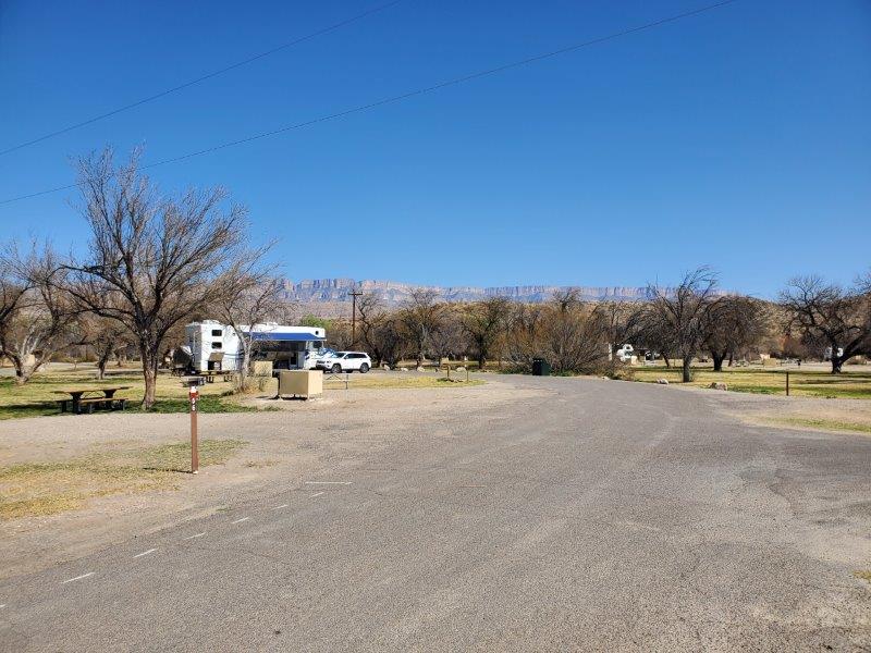
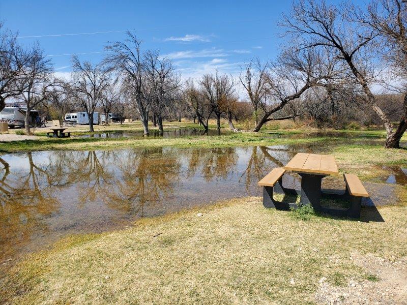
Our campground is located right along the Rio Grande River, thus it has an abundance of cottonwood trees. However, to keep this campground from being a total desert, the park service floods the campsites periodically from an irrigation canal off the river. It keeps stuff kind of green and the trees alive.
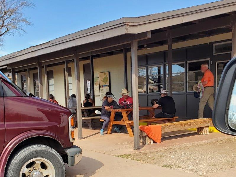
One other thing about Big Bend (and most Nationals Parks) is the lack of cell towers. You can occasionally pick up a signal on high ground, but our campground had ZERO bars. The nearby campground store had free WiFi and a patio. We would pop over there a few times a day to check email, etc.
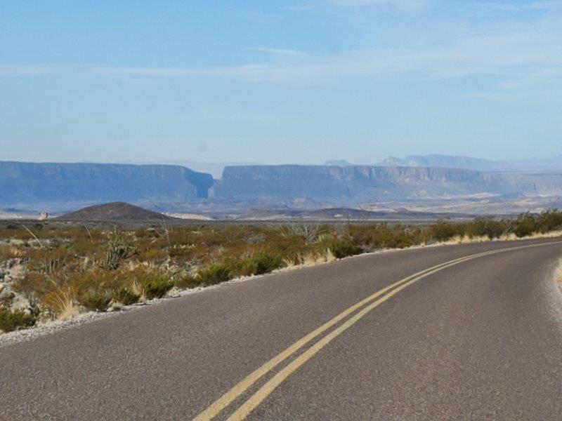
Enough of our accommodations, let’s see what the park had to offer. The park is BIG and our Jeep got a workout exploring it all. There are three distinct areas to the park, the river, the mountains and the desert.
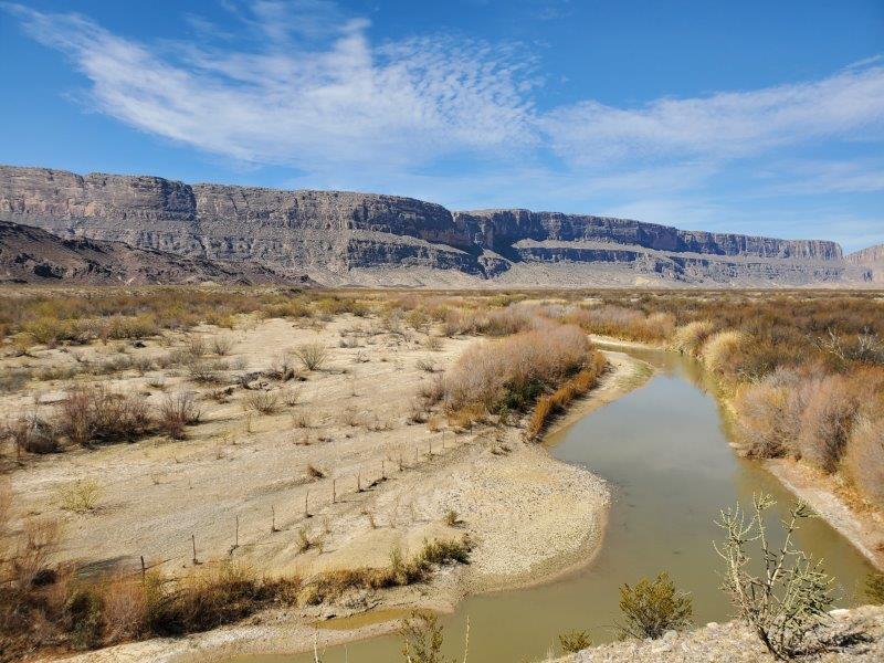
The Rio Grande River
The river runs for 118 miles along the southern border, through flood plains and canyons. We set out to explore, maps, guidebooks, GPS and the All Trails app in-hand.
Near our campground was the town of Boquillas Del Carmen. This town is the only legal border crossing to Mexico within the park. We decided to not visit, but if you have your passport and $5 (to pay for the row boat ride across the river), you can visit the town. I overheard people discussing their visit, apparently the town has two restaurants and nothing more.
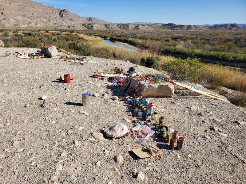
We discovered that anywhere park visitors can easily get near the river, you will find displays of wares for purchase. Mexican nationals cross the river, set up their wares and a jar to collect money, then go back to Mexico. All the park literature ask you to not purchase the wares because it encourages illegal crossings.
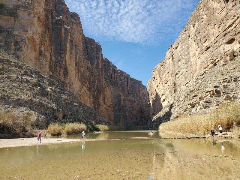
Nearby is Boquillas Canyon for which the little town is names. The canyon was carved into the rock by the river. There is a short hike that you can take to enter the canyon and walk along the river’s edge.
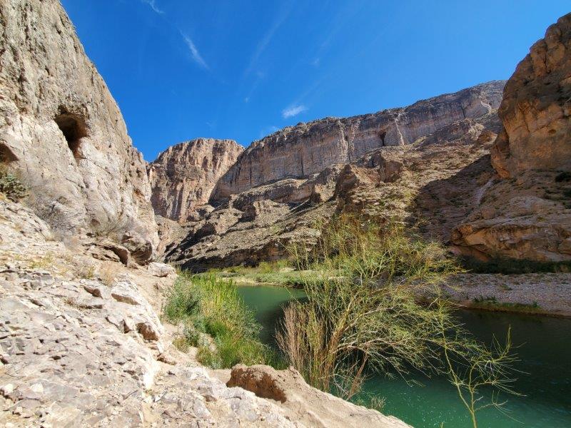
On the west side of the park is Santa Elena Canyon, again a canyon cut into the rock by the water.
pick – we spotted the slot canyon from a distance away.
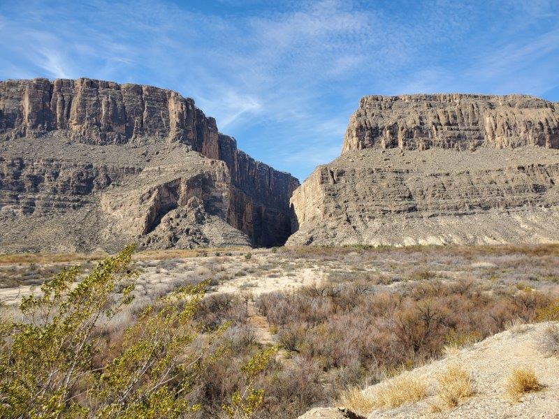
Santa Elena Canyon is one of the most popular places in the park. We were all set to take the canyon hike when we discovered the trail was flooded. People were either walking right through the water in their hiking boots or taking off their boots and socks to get to the trail. Nope…our new knees were NOT going to try this.
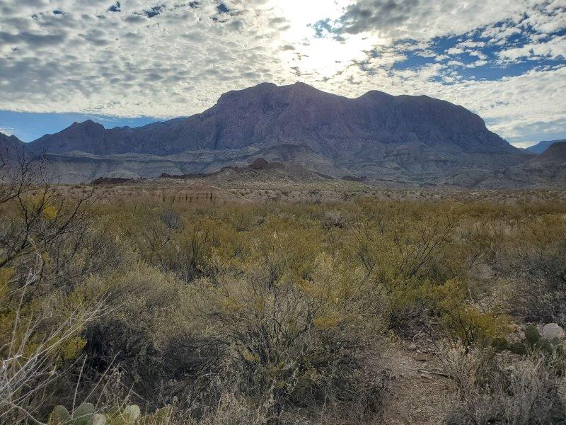
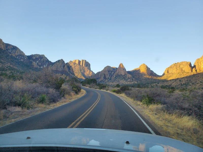
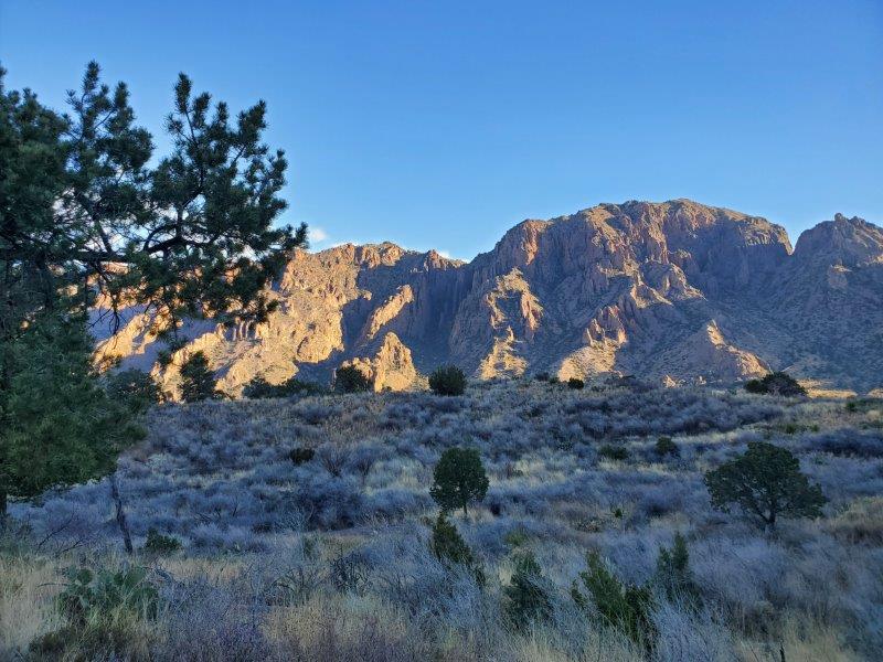
The Chisos Mountains
Right smack in the middle of Big Bend National Park are the Chisos Mountains. Formed from volcanic rock, the literature calls it a “green island in a sea of desert.” You can see the mountains from all parts of the park. It is the centerpiece of Big Bend.
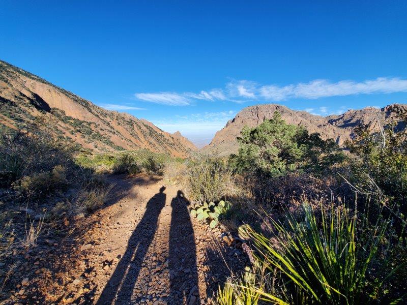
We had been warned that the Chisos Basin (lodge, hiking trail heads, parking for tourist buses) in the heart of the mountains was very popular and to get an early start to beat the crowds. We has quickly learned that getting an early start allowed us to beat the heat of the afternoon (we were over 90 degrees most days).
We did a two mile hike (with some elevation gain) around the Chisos Basin. That may sound wimpy to some, but this is the longest hike Jim has done since last summer when he got sick. The hike started out with us wearing long sleeve jackets, we were down to shirt sleeves by the time we were done. It might have been 45 degrees when we started out, but it was 70 degrees by the time we finished. And as I mentioned, it was over 90 degrees down off the mountain.
The Chihuahuan Desert
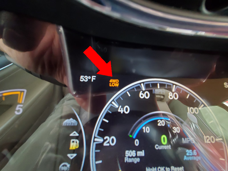
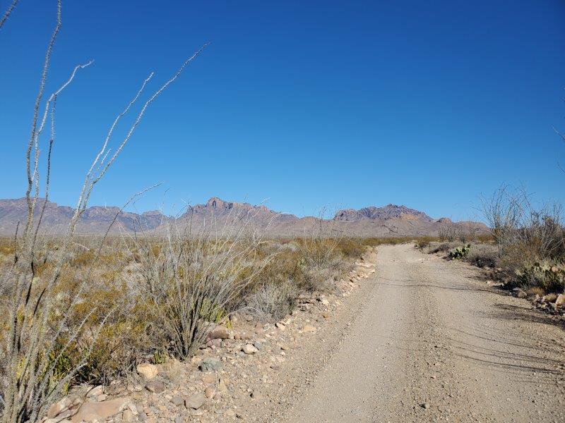
As I mentioned, we did a lot of driving, and not just on the main roads. Jim loves to get the Jeep out on dirt roads and get it all dusty (inside and out).
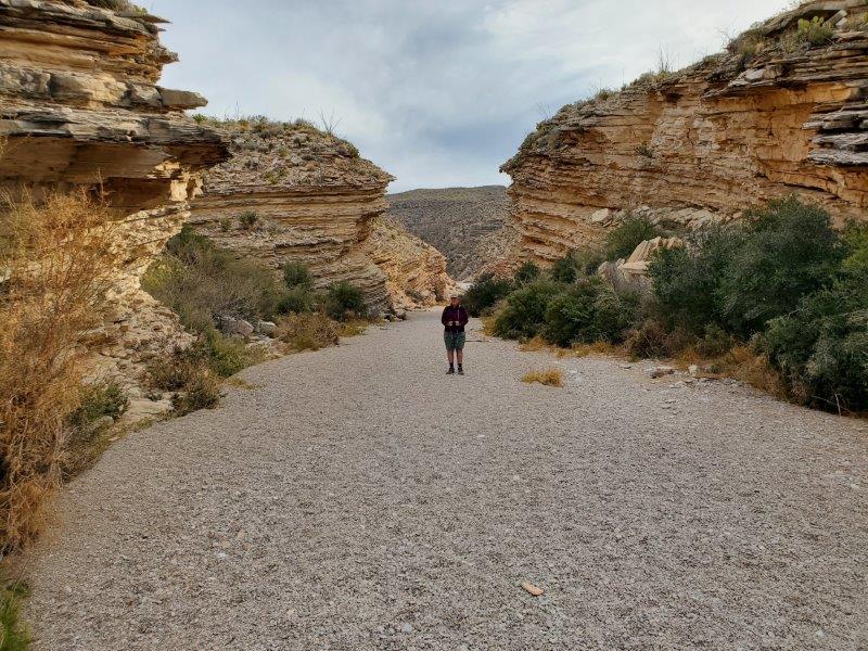
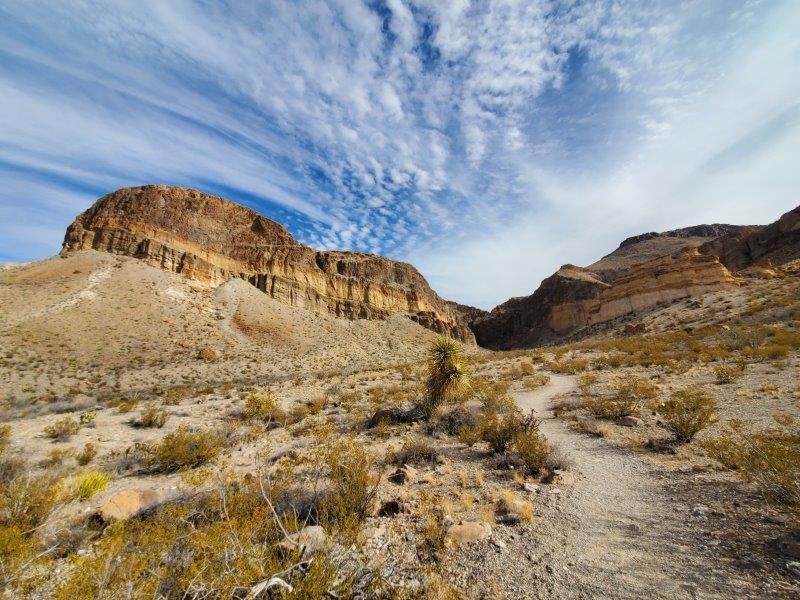
We traveled the Old Ore Road to get to a special hike. This was the worse road in the park, it took us an hour to go 5 miles.

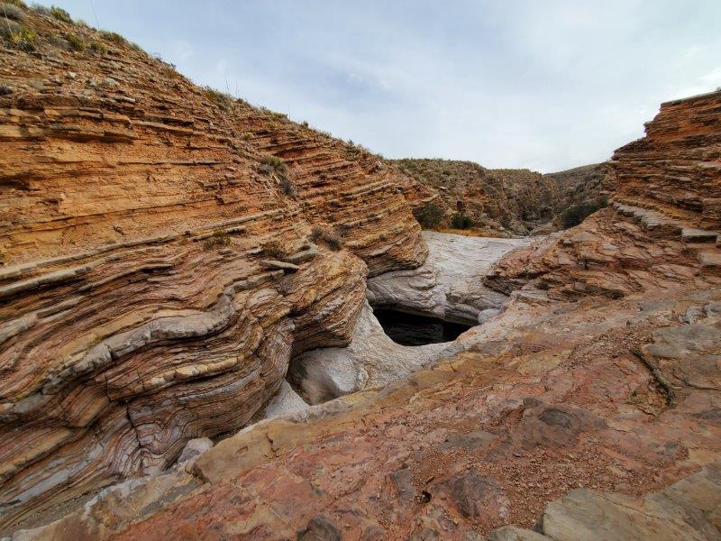
This road led to a hike called Ernst Tinaja. This was probably the best hike of our stay. A Tinaja is “a jar or scoop-shaped bedrock depression that holds rainwater.”
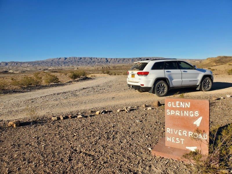
Another day we traveled along the River Road East and Glenn Springs Road. It afforded some great, wide open views.
At one point we spotted this path that went from one side of the road to the other
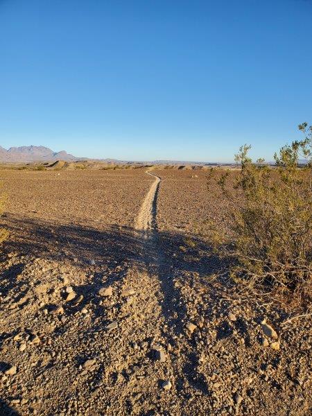
Then we noticed the foot prints of the path’s owners.
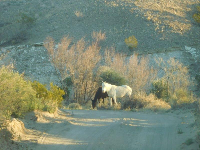
Indeed, wild horses!!!! We saw hoof prints on those paths.
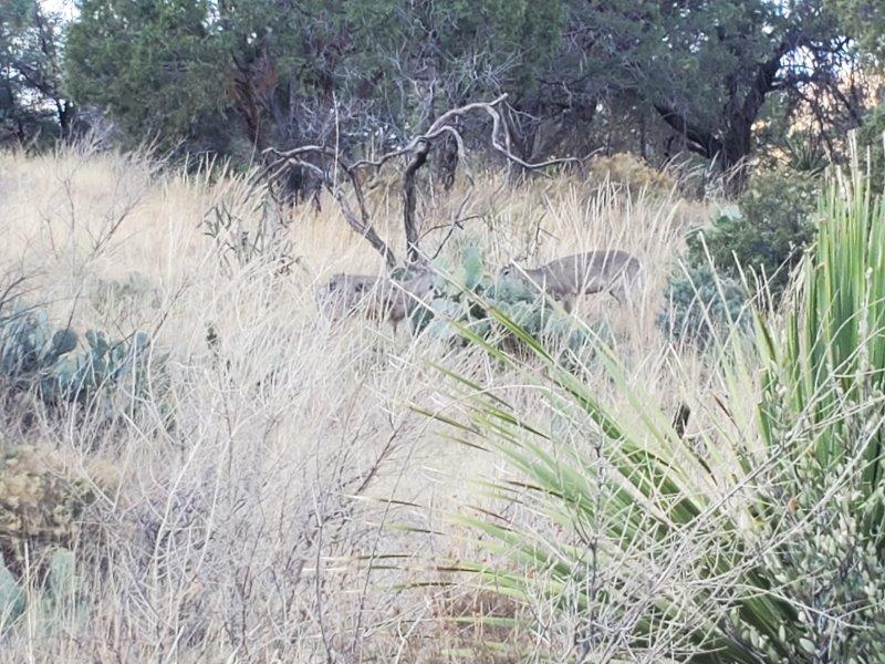
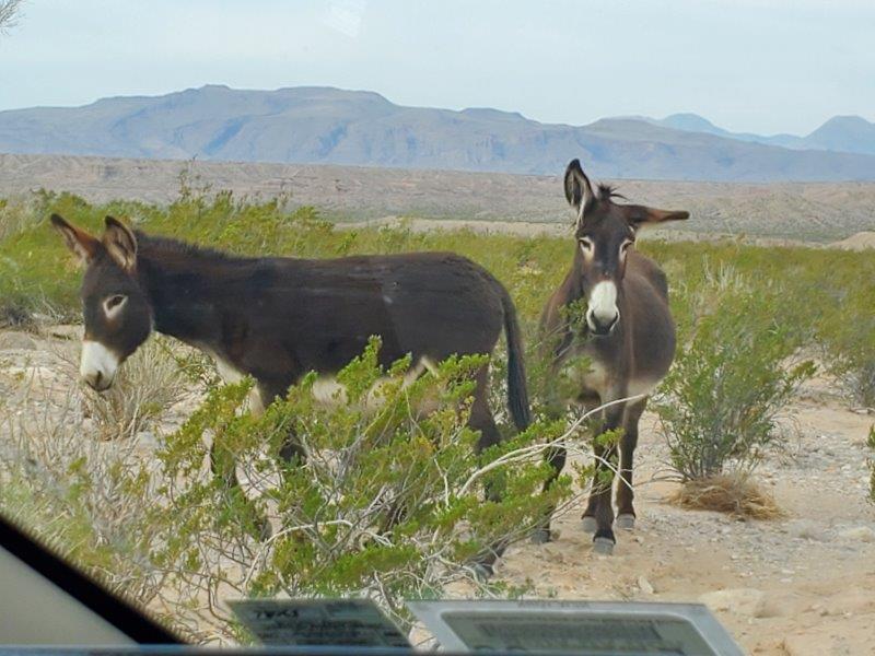
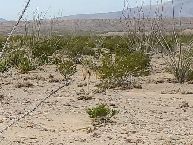
We met a few other park dwellers.
I think we have got all we could out of our week in Big Bend National Park. It felt good to play tourist again.
As usual, very nice pictures — thanks!!!! The “Ernst” hike looked very interesting. Your knees probably made the right decision for not going through the water. 🙂
On our bucket list!