First, let me share a website so you can see where we are in real time on days we are driving. We have a Garmin InReach Satellite communicator, purchased for use in case of an emergency where there is no cell service. The device will send a location to a satellite tracking system every 10 minutes. The website is https://live.garmin.com/jc2025. jc2025 = James Corinne year 2025. Get it? Feel free to stalk us.
This blog post deals with how to navigate the Alaska Highway. You know, the nuts and bolts of things. The next blog post will detail what we did along the way!
We have put a lot of miles behind us since our first Alaska post. That post saw us back in Hinton, Alberta, way, way south. After a couple of nights in Hinton to regroup, it was time to head north.
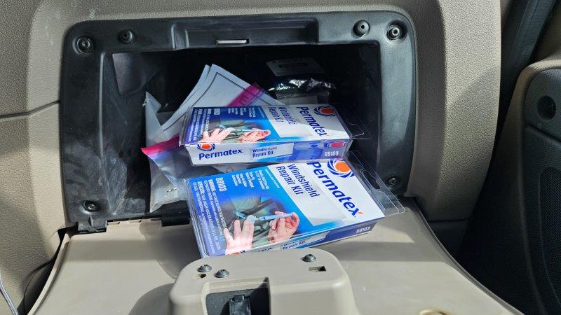
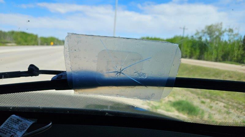
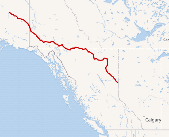
We had to drive 290 miles to get to Dawson Creek, the official start of the Alaska Highway (known as the ALCAN during World War II when the highway was constructed by the US Army in just 10 months). There are all sorts of preparations RVers are told to make when RVing through Northwestern Canada and Alaska. Don’t let your fuel tank get below half, always take on water and dump our tanks when the opportunity arises, have some Canadian money, and be prepared for windshield chips caused by flying stones.
We were prepared for all of this just in case we ran into issues on the Alaska Highway. Well, we didn’t even have time to get to the Alaska Highway before the first issue arose. BAM. A truck went by and kicked up a stone. You guessed it, we had a chip in the RV windshield and the trip was just starting.
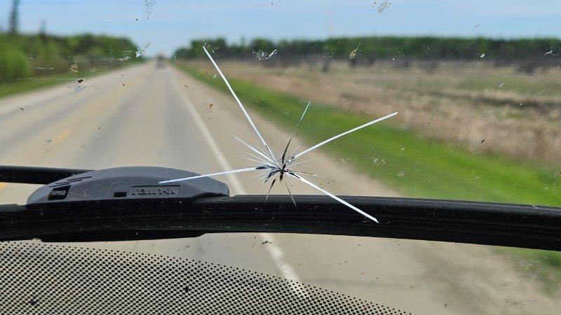
The chip occurred on the passenger side down low. Being the good engineers that we are, we were fully prepared. We had a chip seal kit and some Gorilla tape. This windshield already had two previous chips that we had fixed already. What’s a third? (Said sarcastically.)
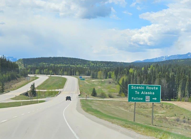
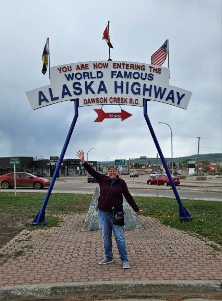
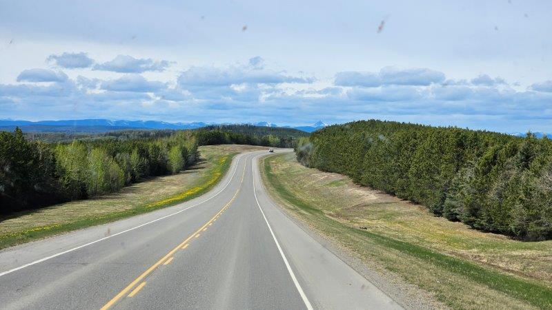
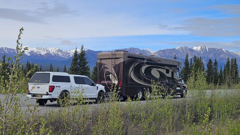
Once the windshield was fixed (and it’s still holding a week later), we made our way to Dawson Creek, British Columbia. This is the true start of the Alaska Highway, Milepost 0. This highway is 1387 miles long. We drove most of it to get to Alaska.
The Alaska Highway lives and dies by the mileposts. You know, those little signs on the side of the road indicating what mile you are at on the highway. Back when the highway was constructed, everything was referenced by mile. In fact, the Alaska vacationer’s bible is called the Milepost! As you traverse the highway, you refer to your copy of the Milepost, see what milepost you are at, and read about what is around you. This is especially useful for finding pull offs, gas stations and other services, hikes, etc.
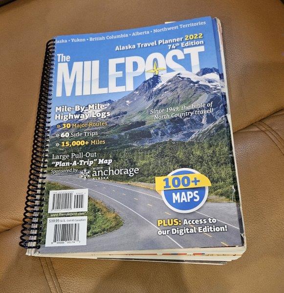
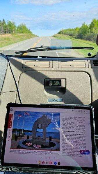
As you probably know, Canada uses the metric system now. So their mileposts are actually kilometer posts. In the Milepost guide, they count off your progress three ways: 1) actual miles, 2) historical miles (what the mileage was back when the road was originally built, currently it is 35 miles shorter because of rerouting and straightening curves, thus historical miles don’t match current miles) and 3) kilometers. I got pretty good at mentally flipping between miles and kilometers and was able to keep track of where we were.
The mileposts are also used as street addresses (for example, Liard River Hot Springs’ address is 479 Alaska Highway, meaning it is located at milepost 479). The mileposts were also used to name natural features of the land, such as “112 Stream” (the stream crossing the road at milepost 112). The system kind of makes sense…until you flip a country from miles to kilometers. Whatever.
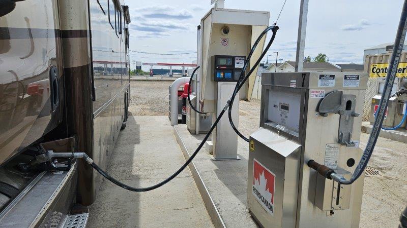
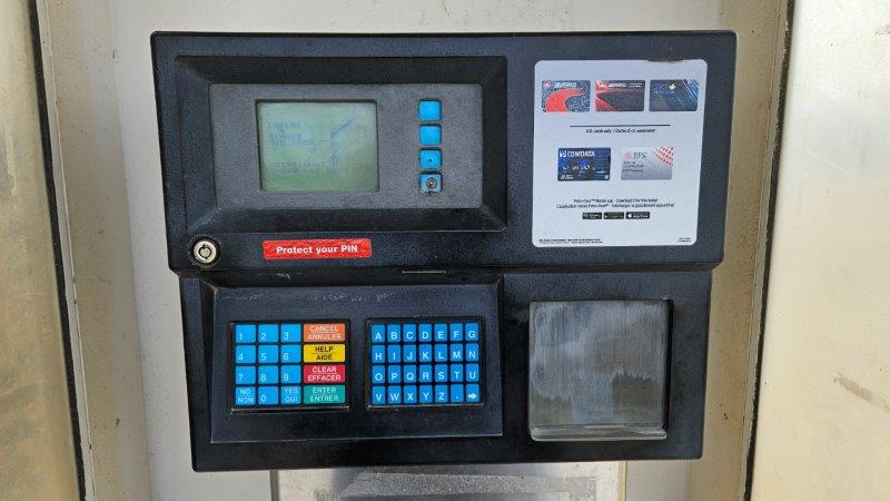
Diesel Fuel
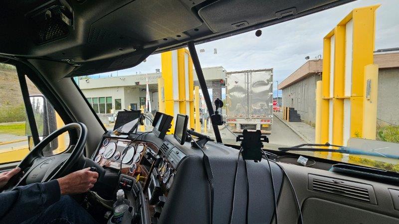
Driving the RV thousands of miles of course means you need to put diesel in it, lots of diesel. In the USA, we typically use truck stops (Love’s, TA, Pilot, Flying J). In Canada, you use what is called a cardlock. They are standalone fuel pumps in the middle of nowhere. There is not a store associated with them. And they don’t take credit cards
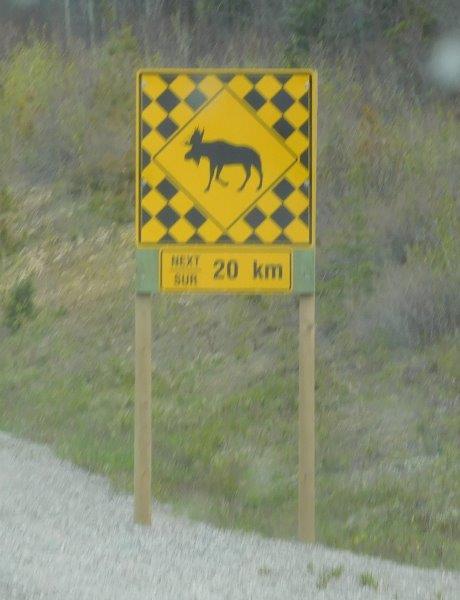
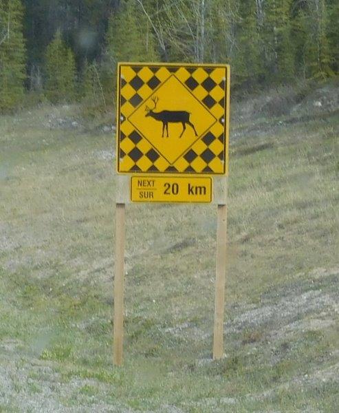
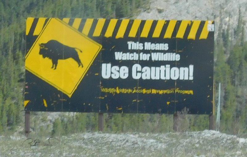
Signs
The Alaska Highway has some very unique signage along the road way.
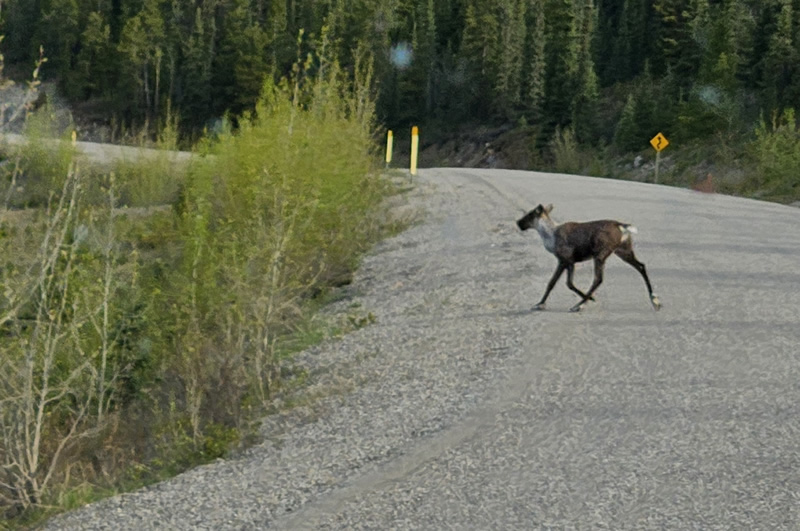
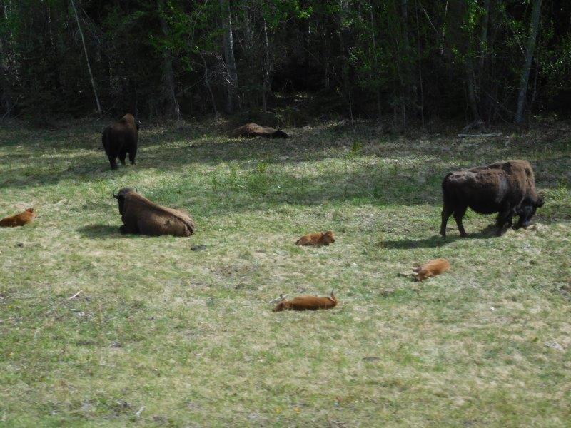
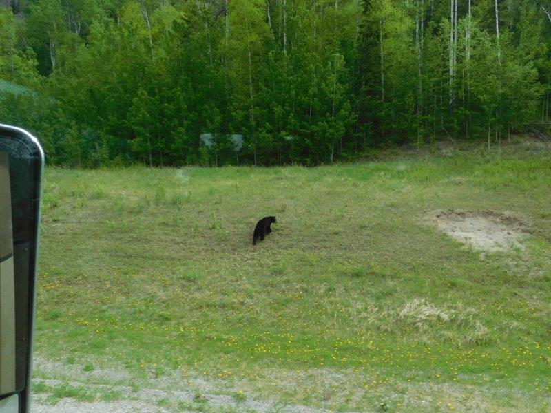
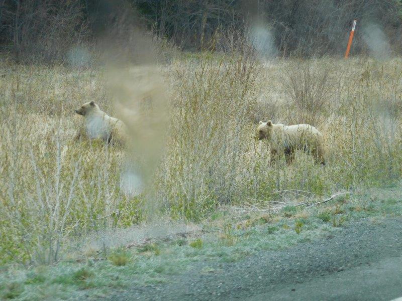
Critters
Let’s talk about the animals you can see on the Alaska Highway, especially since the signs kept warning us to watch out for them. I started keeping score.
Caribou: 3
Black Bears: 3
Bison: Too many to count
Elk: 2
Grizzly: 3
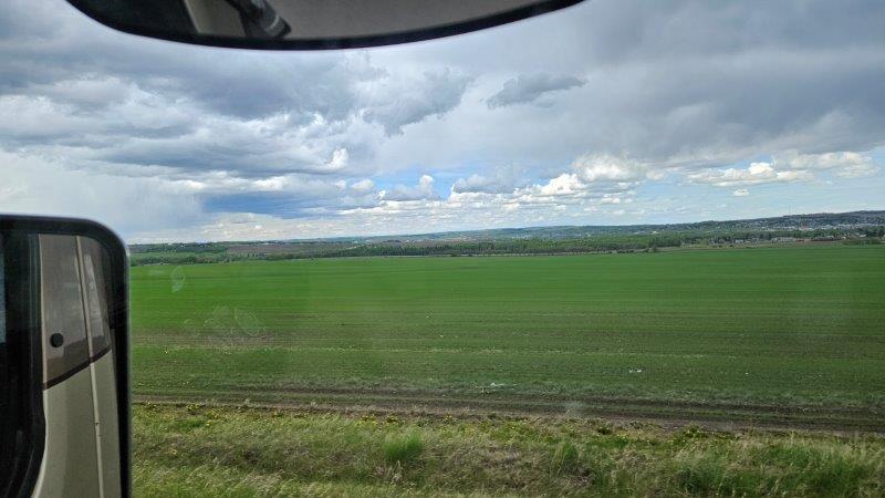
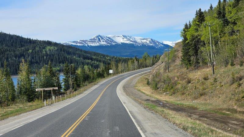
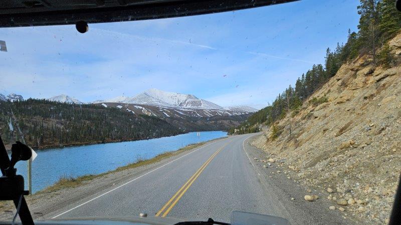
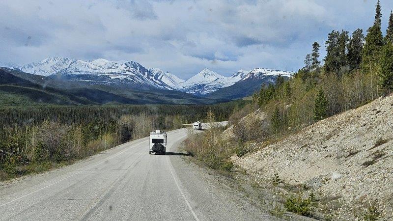
Mountain views
It’s a good thing photography is mostly digital now. Because I took so many pictures of the mountains as seen through our sometimes buggy windshield, processing traditional film would have broken the bank!
Snow
Yup, you read that right. On one of the days of travel, we encountered snow! We weren’t expecting that. We decided to pull into a visitor’s center parking lot and wait it out a bit. Fortunately, it only lasted a couple of hours. Ugh.
Destruction Bay to the Alaskan Border
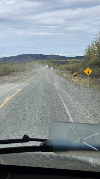
By day 6 on the Alaska Highway, we had left Alberta behind, been in British Columbia for a while, entered the Yukon, and finally came to Destruction Bay, Yukon. Things were about to get interesting. I had read about being mindful of frost heaves and pot holes on this section of the Alaska Highway. No amount of warning can prepare you for what is to come.
It took us about four hours to do the 230 kilometer stretch (140 miles). The frost heaves are marked (most of the time) to warn you to slow down. But it is impossible to avoid any jostling unless you are going only 5 miles per hour. We weren’t. It’s also impossible to take any pictures while moving. You couldn’t hold the camera still!
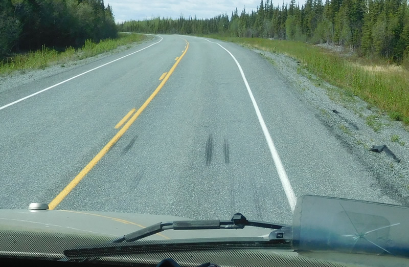
When we had stopped at a visitor’s center in the Yukon, the woman there warned us to look for skid marks. That would indicate a dip in the road (probably due to a frost heave). I didn’t think much of it at the time. I just figured that idiots were braking too hard when they came to a dip.
Once we finished that 140 miles of really rough road, this is what we found happened in the RV…a ceiling fan remote had bounced off its cradle on the wall, the glass turntable in the microwave had bounced off its base (but didn’t break!), my sewing machine almost took a tumble out of its cabinet (I had tied the handles shut about halfway down the bumpy road…thank goodness) and a few other things took flying leaps. But nothing was broken. Sorry, I didn’t think to take pictures. I was too busy surveying the carnage.
But don’t let this discourage you from traveling the Alaska Highway. Just be forewarned and have everything stowed. The next time we hit bumpy roads, we were much better prepared.
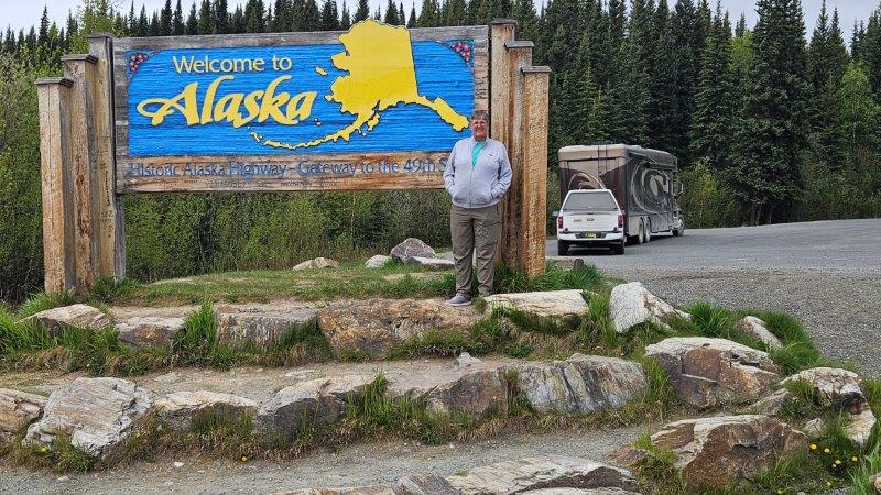
Welcome to Alaska
Finally, it was time to enter into Alaska!
Our trip through customs was pretty much uneventful. The agricultural inspector came on board and went through the refrigerator. He took my raw eggs (bird flu concerns) and a green pepper and tomatoes. They left me the apples that had a “USA” sticker on them.
A new campground amenity!
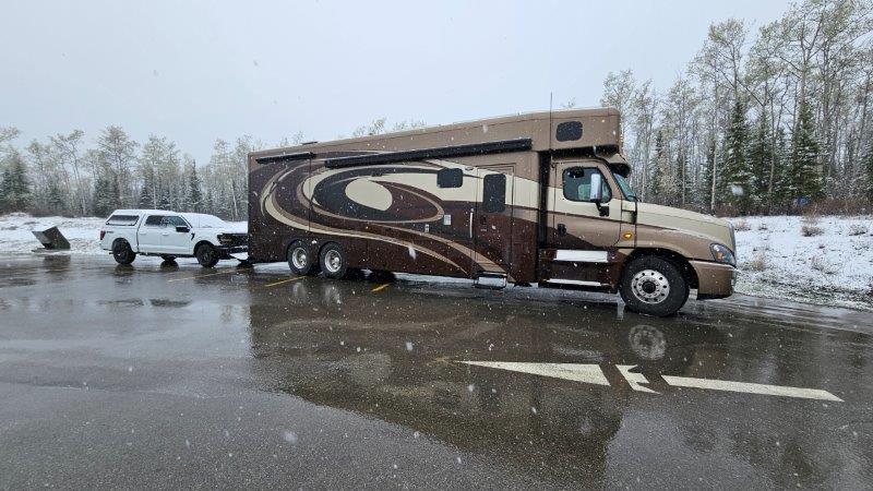
We made the final push to Tok, Alaska, about 90 miles into Alaska. Upon arrival, we were aghast to see how filthy the RV and the truck were after that drive messy, bouncy ride.
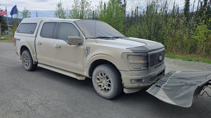
Well, it turns out that most campgrounds in this neck of the woods have car and RV washing stations. For $20, we had the use of two power washers for as long as we needed to get the dirt off the vehicles. The truck REALLY needed it. You could not see out the windows.
Now James wants to share some statistics with you…take it away James.
From our house to the Alaskan border was 3566 miles. Just a hop, skip, and a jump. Most of the Alaskan border with Canada is east longitude 141 degrees. The Alaska sign pictured with Corinne is right at the border. At the border there is a “path” about 100 feet wide cut through the forest extending in both directions as far as the eye can see.
We did have one stop planned in Canada. The “Best Cinnamon Rolls In This Galactic Sector”. At least that is what their sign proclaims. Since we are talking about things on a galactic scale, let’s use measurements to suit. The mean earth to sun distance is one astronomical unit, or AU. So the distance from our house to the best cinnamon rolls was 0.000000001838 AUs (or 2750 miles). Are they the best in a galactic sense? Having only inhabited this planet, I can’t answer that. They were darn good. Would I stop again? Yes!
This post has gone on long enough. Our next post will tell you what we did along the Canadian portion of the Alaska Highway. Stay tuned.
Glad to hear you have made it to Alaska. Since traffic was normally light during our trip in 2019 Randy drove down the middle of the road quite a bit to miss a lot of the frost heaves.
Traffic was pretty light for us also. Trust me, James was all over the road avoiding those potholes. We drove down the Richardson Highway towards Valdez yesterday. Someone told us that road was also bad. It wasn’t. It was a breeze compared to the northern ALCAN.