Welcome to a bonus post in our Alaska series….not centered on Alaska or Canada. We decided that on our way back to New Mexico, we would hit up some of Nevada, Utah and Arizona’s National Parks and Monuments. Well, some of them anyway. There are more parks and monuments than we have the time and energy for right now. But here’s what we saw.
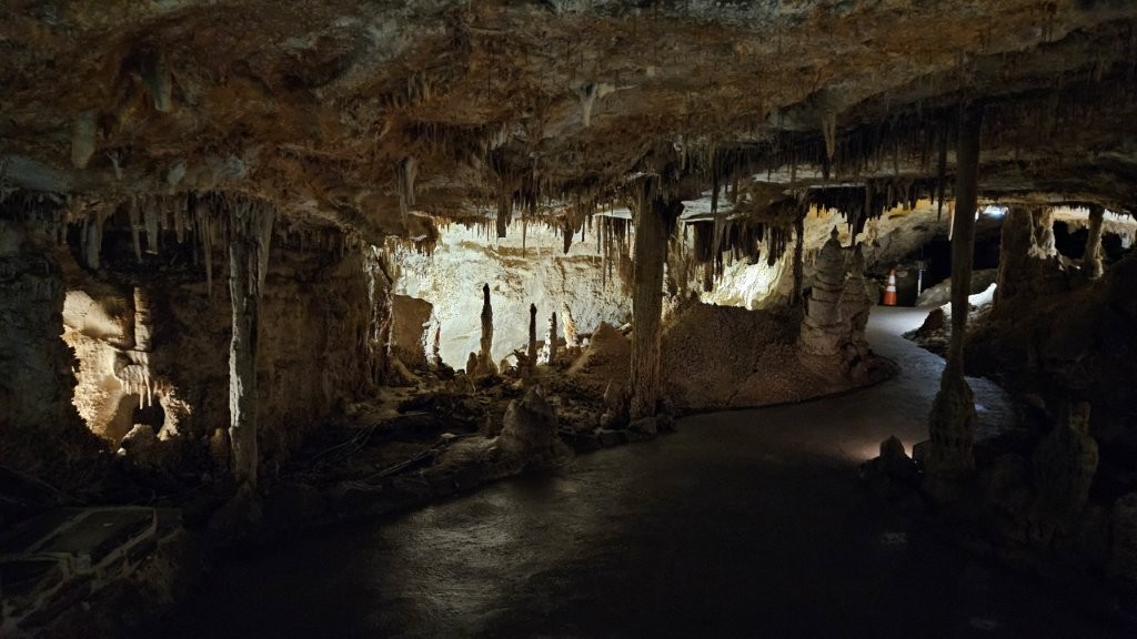
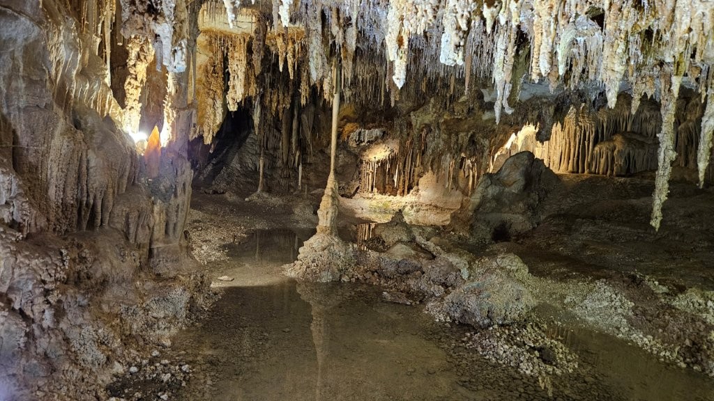
Great Basin National Park
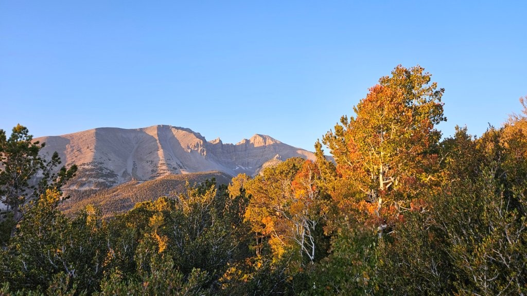
Great Basin is a little visited National Park located in east central Nevada. One day was plenty of time to see all there is. But a good day it was. The park derives its name from the Great Basin, the dry and mountainous region between the Sierra Nevada and the Wasatch Mountains.
Cedar Breaks National Monument
Of all the places we visited on this little detour, Cedar Breaks was our favorite, due to the lack of crowds and outstanding scenery. We had never heard of Cedar Breaks, so thanks to Wade and Debi for the recommendation. Cedar Breaks is located east of Cedar City, Utah.
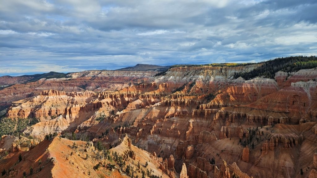
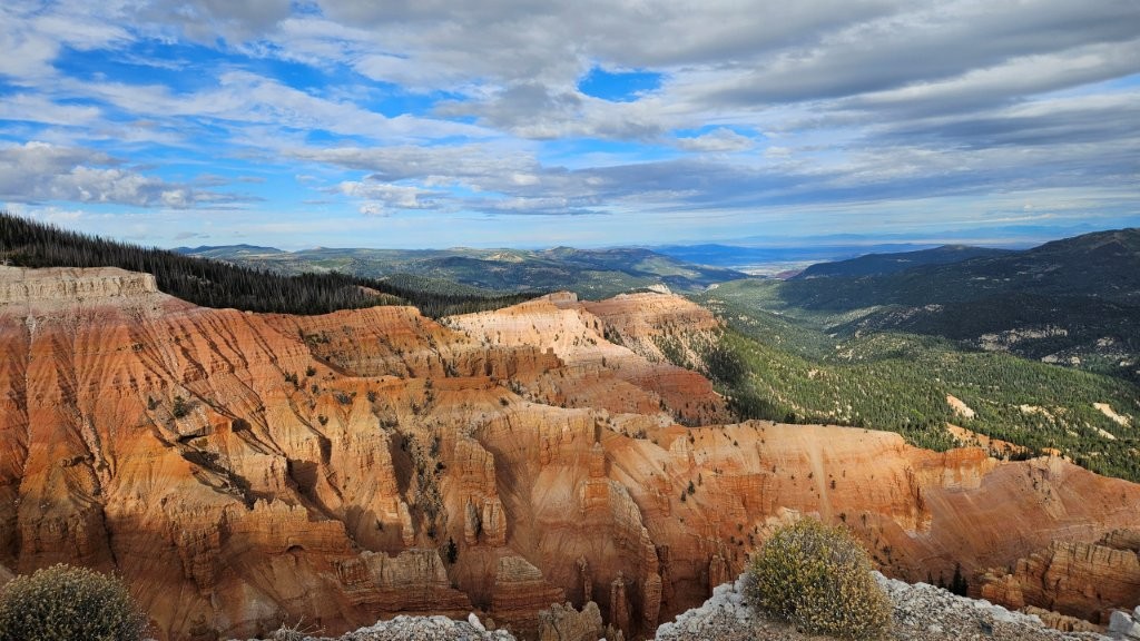
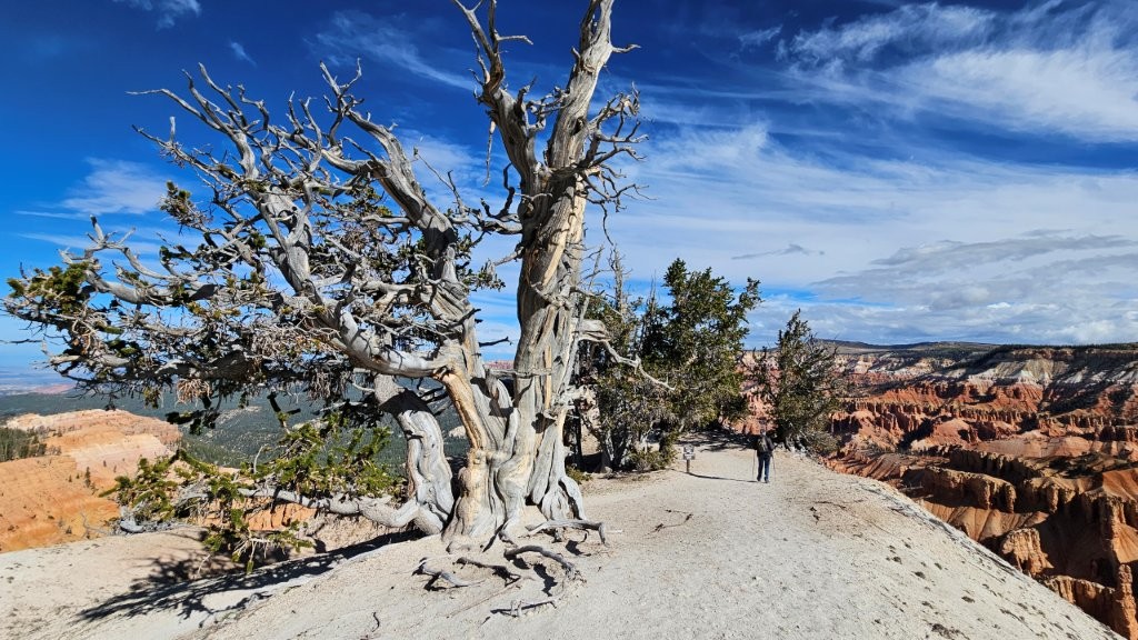
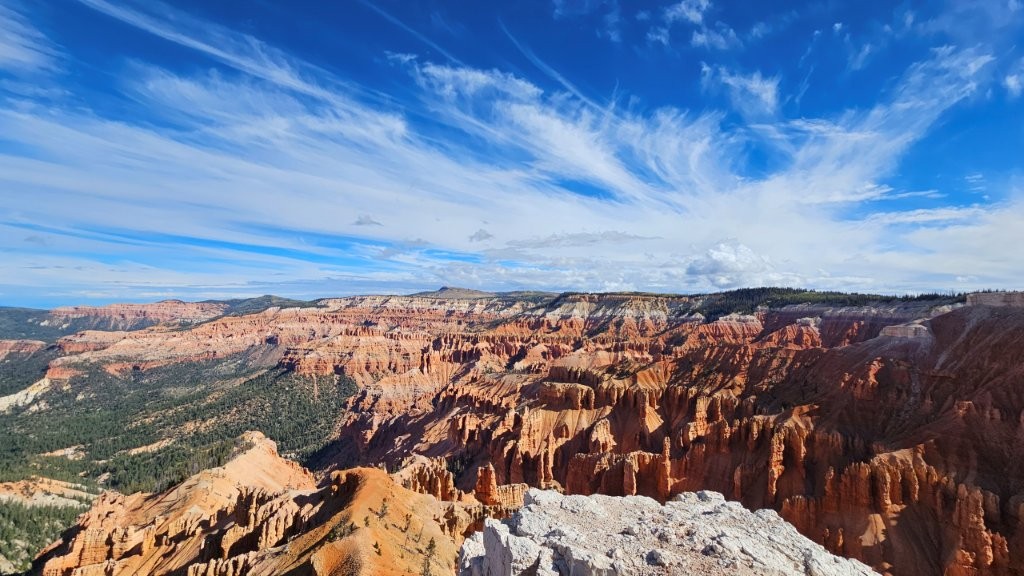
If you are ever in the area, we HIGHLY recommend Cedar Breaks National Monument.
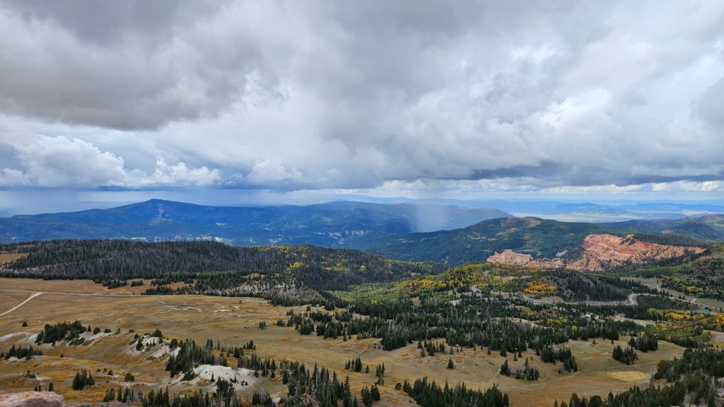
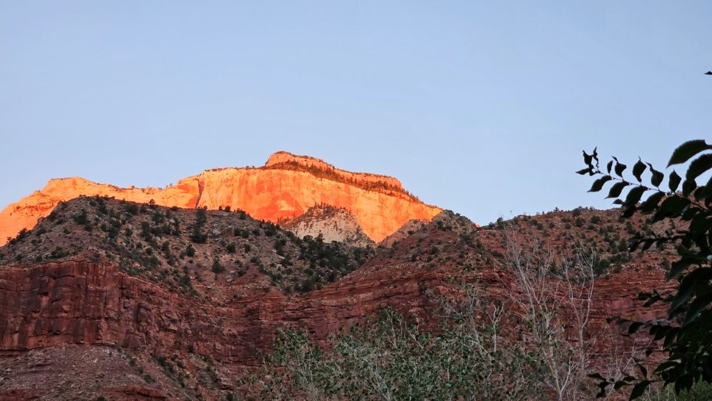
Kanab, Utah
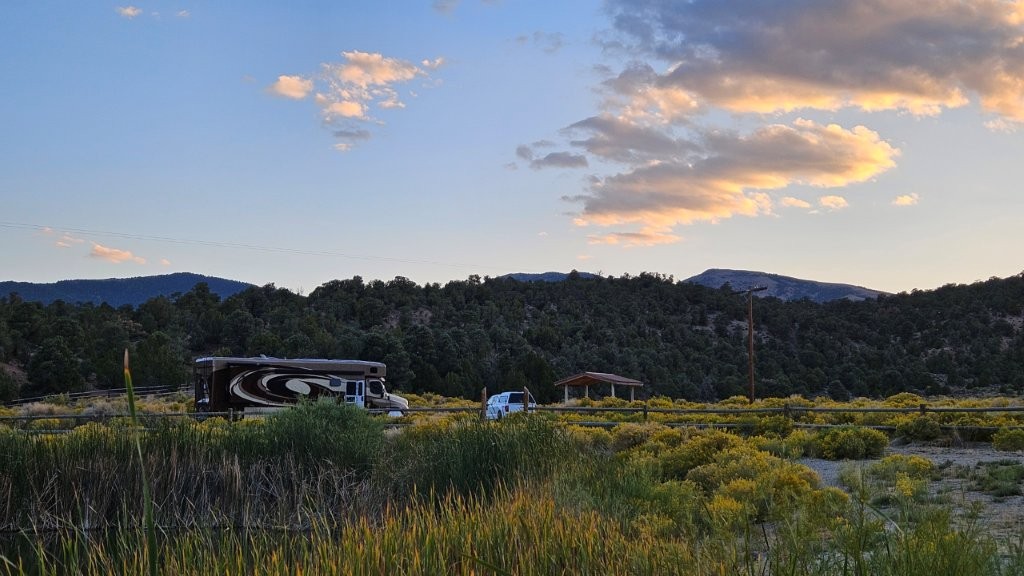
At this point, we decided to plant ourselves in Kanab, Utah for a week. This was our 62nd campground on our almost 5 month trip. We needed a break from moving almost every day.
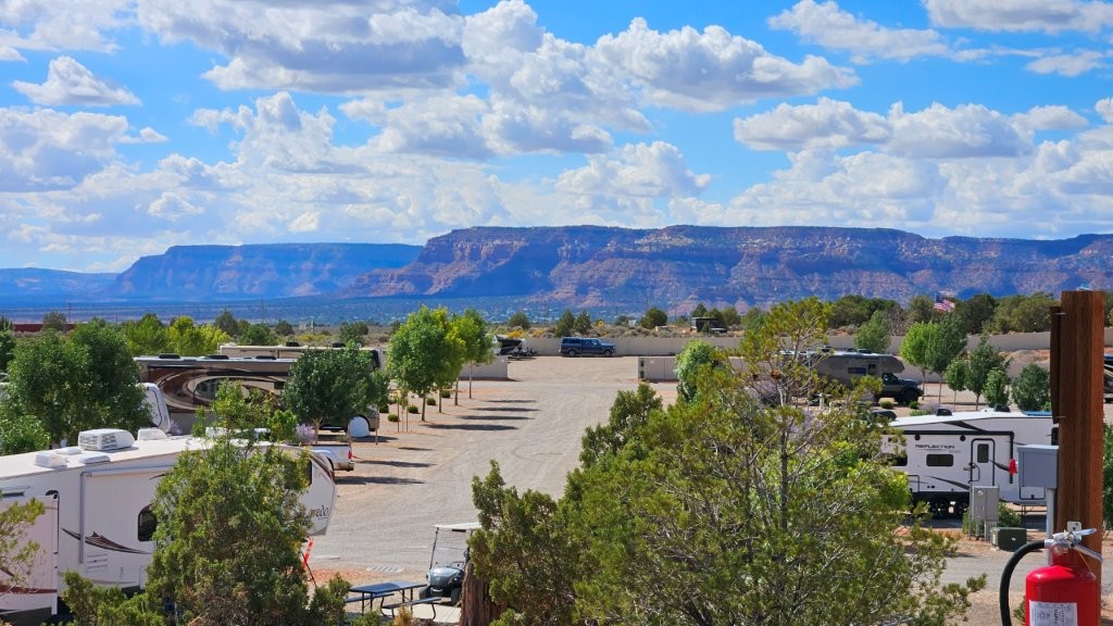
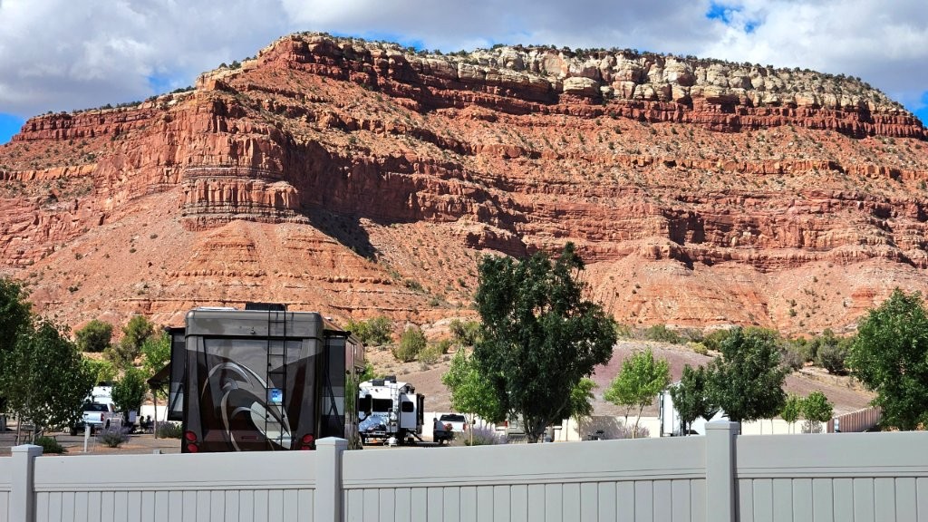
This was our view looking out the front of the RV.
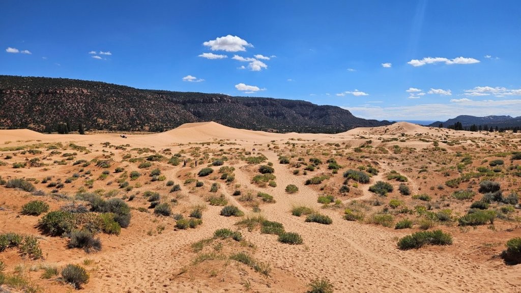
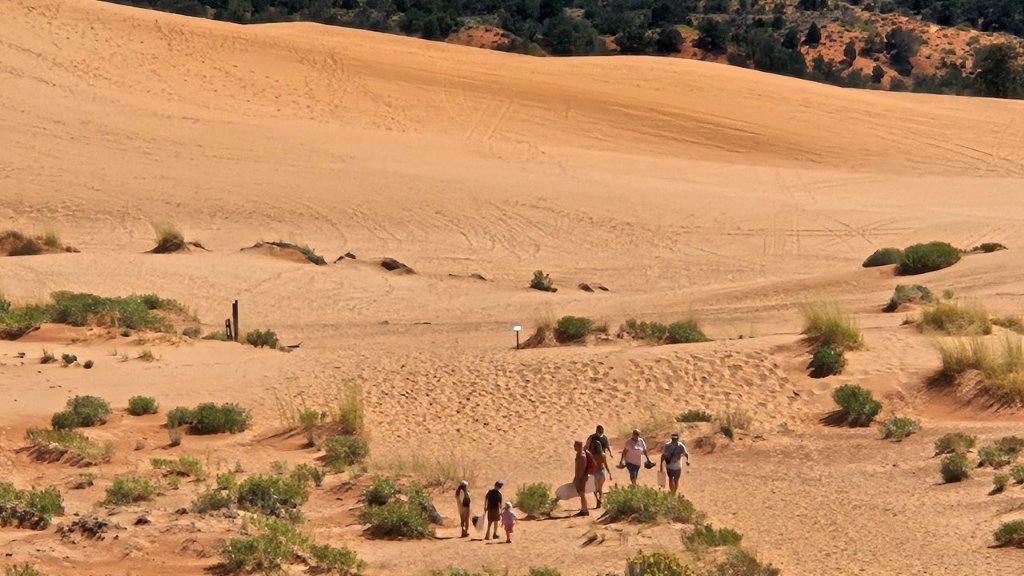
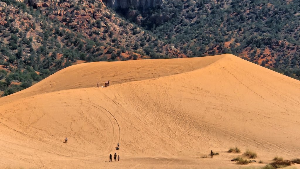
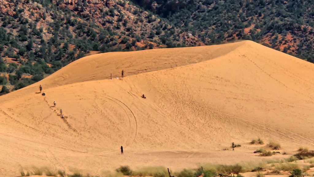
Pink Coral Sand Dunes State Park
Outside of Kanab was Coral Pink Sand Dunes State Park. Within the park were two excellent campgrounds that are on our list for our next visit.
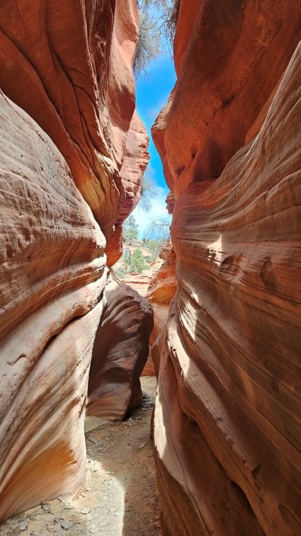
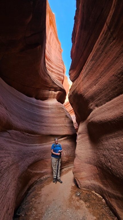
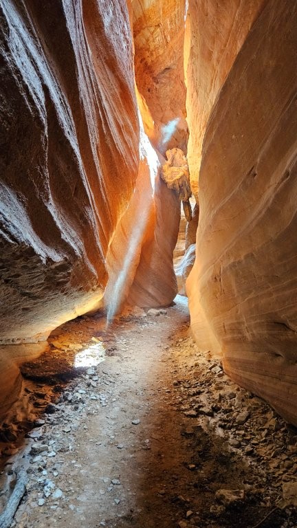
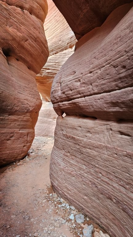
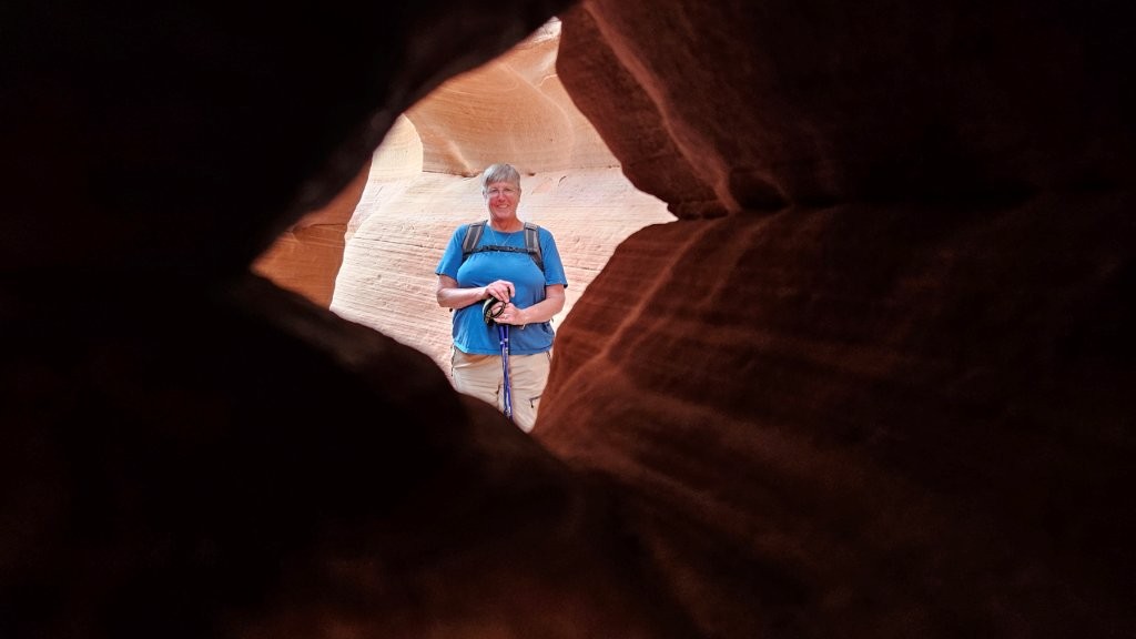
Peak-a-boo Slot Canyon
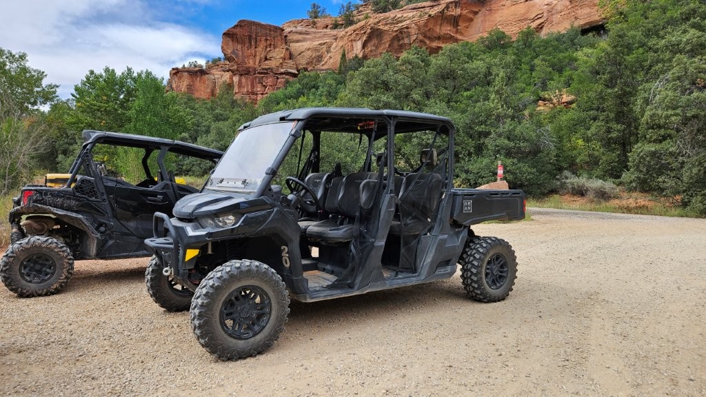
Also within easy reach of Kanab is the Peak-a-Boo Slot Canyon. You have to go through 3 miles of VERY sandy trails to get to the entrance of the canyon. Some people hike it. Some people will drive their high-clearance 4 wheel drive vehicles. Others, like us, did a guided UTV tour! (UTV = Utility Vehicle)
I shot a short 30 second video of what it was like to ride on the UTV. It was not easy to hold the camera securely AND try to hang on for myself. The video link is here if the embedded video doesn’t work for you: https://youtu.be/qHlQzLdV3QM?si=FPomZLUlitkYL2u9.

The UTV ride was a lot of fun! Our experience kind of explains why there are so many UTVs parked next to RVs in the RV Park we stayed in.
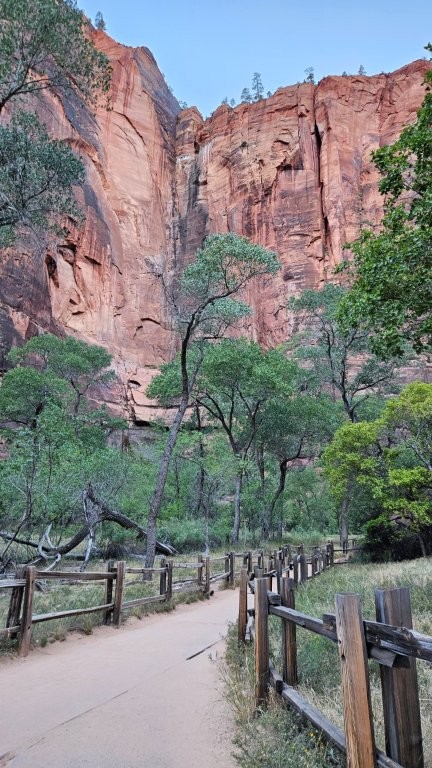
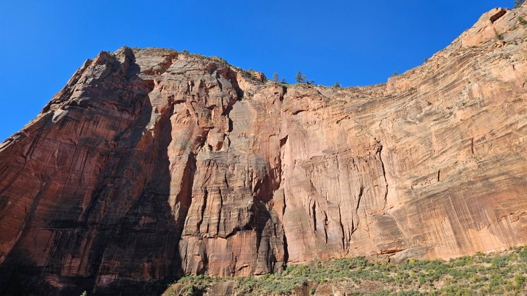
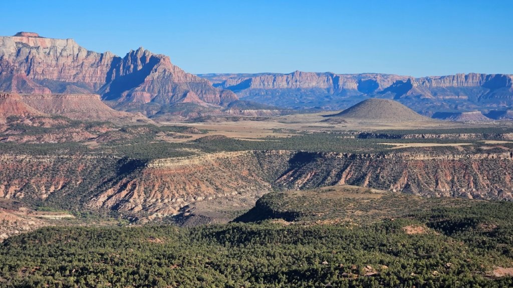
Zion National Park
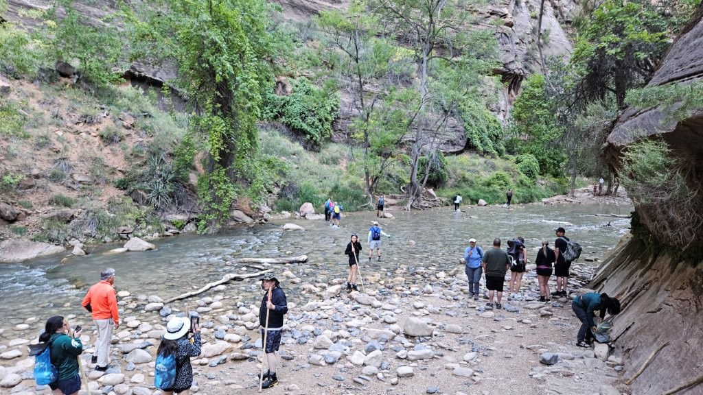
To be honest, we had no idea what to expect of Zion. It turns out Zion is tied for second (with the Grand Canyon) in the list of most visited National Parks. Number one is the Great Smokey Mountains National Park. We believe it, based on the crowds we saw, and it’s not even peak season!
The heart of Zion is a canyon carved by the Virgin River and it seven miles long. You have to take a free bus to visit the length of the canyon.
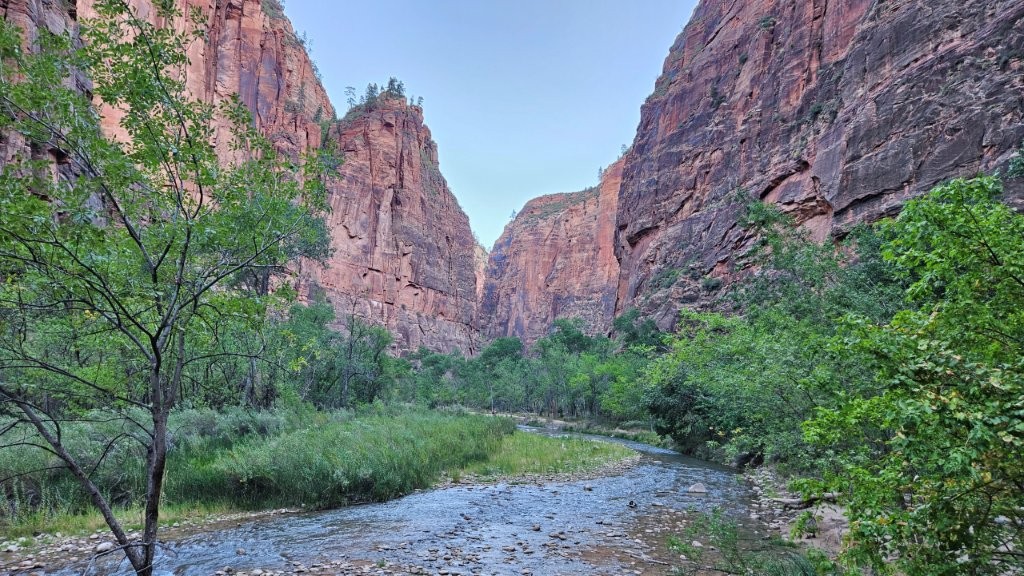
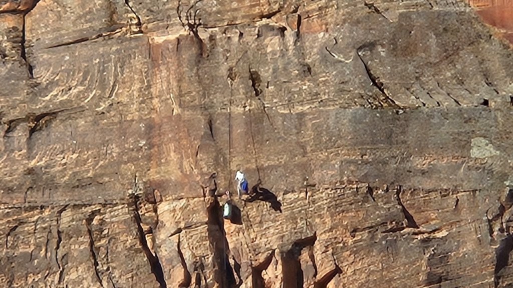
Have you heard of The Narrows? This seems to be why everyone comes to the Park, to hike further up the canyon in the river. Some hikers grab their water shoes and trekking poles and just go for it. There is an outfitter just outside the entrance to the park that will provided you (for a fee) with what you need to hike the narrows. I just peeked at their website to see the pricing.
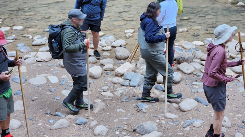
The Dry Bib Package includes:
Dry bibs (waders)
Adidas Hydro Lace Canyoneering Boot
5mm Neoprene Socks
Wooden Hiking Stick
Dry Top (additional $10)
It was easy to spot the people heading into the Narrows. They all had on matching footwear rented from an outfitter. If we were 30 years younger, we would be tempted. As it was, it was 50 degrees air temperature and we WERE NOT tempted.
If you want to see more about hiking the Narrows, I recommend this video by Keep Your Daydream. It’s long, but pretty good. https://youtu.be/3qnUidAsvpY?si=RfA3HgwFAK32IqfY
Flash flooding is a concern in Zion. There were all sorts of signs warning you to be aware. Towards the end of our week in Kanab, we had an evening of thunderstorms. The next morning, the flash flood level in Zion was “Probable.” Yikes!
All in all, Zion was nice, but I think we are getting jaded. After all the sights we saw this summer, we are getting hard to impress. I think we need a reset.
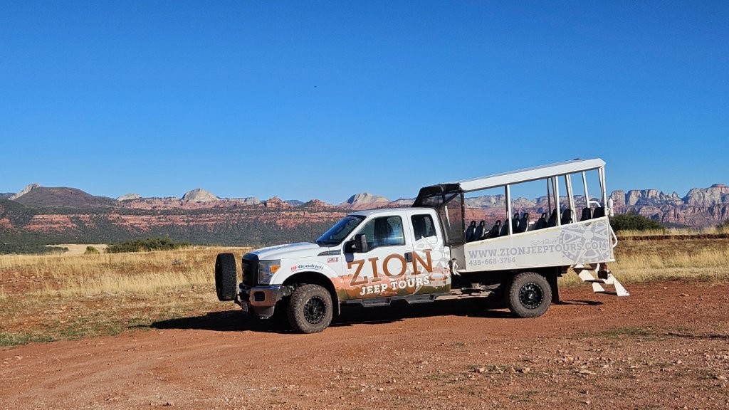
Zion Mesa Tour
But we weren’t done yet with Zion. We booked a Zion Mesa Jeep Tour for the afternoon to see the sights outside the National Park.
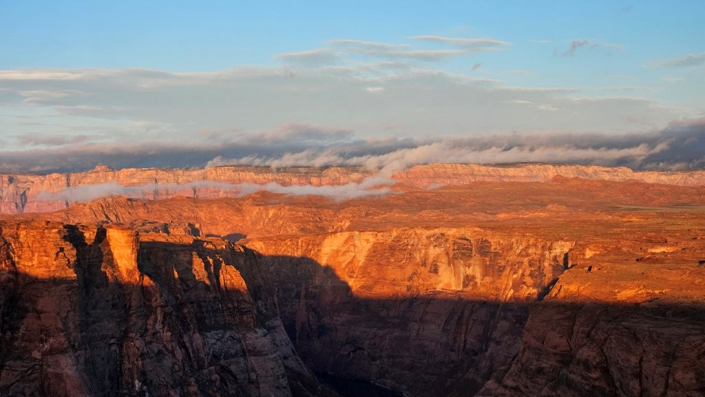
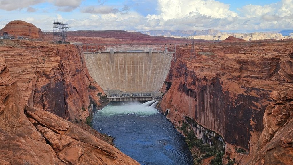
Glen Canyon National Recreation Area
We finished off our whirlwind tour of SOME of what the Southwest has to off with a visit to Page, Arizona, Lake Powell and the Glen Canyon National Recreation Area. We had last been in this area in 2004. At that time, we rented a house boat and spent five lovely days on Lake Powell. We never dreamed that we would be back in this area in an RV! What has changed in the succeeding 21 years?
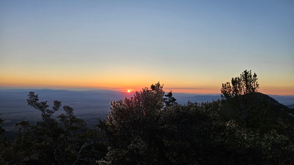
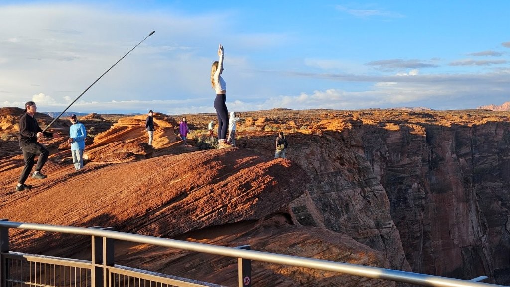
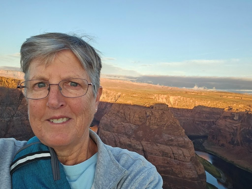
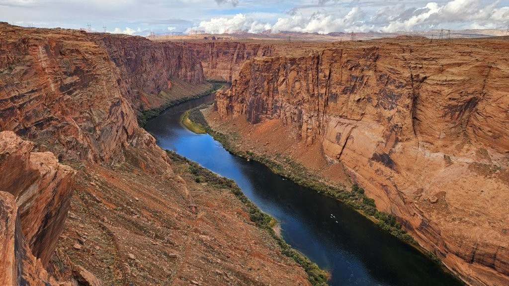
We started out our explorations at Horseshoe Bend at sunrise.
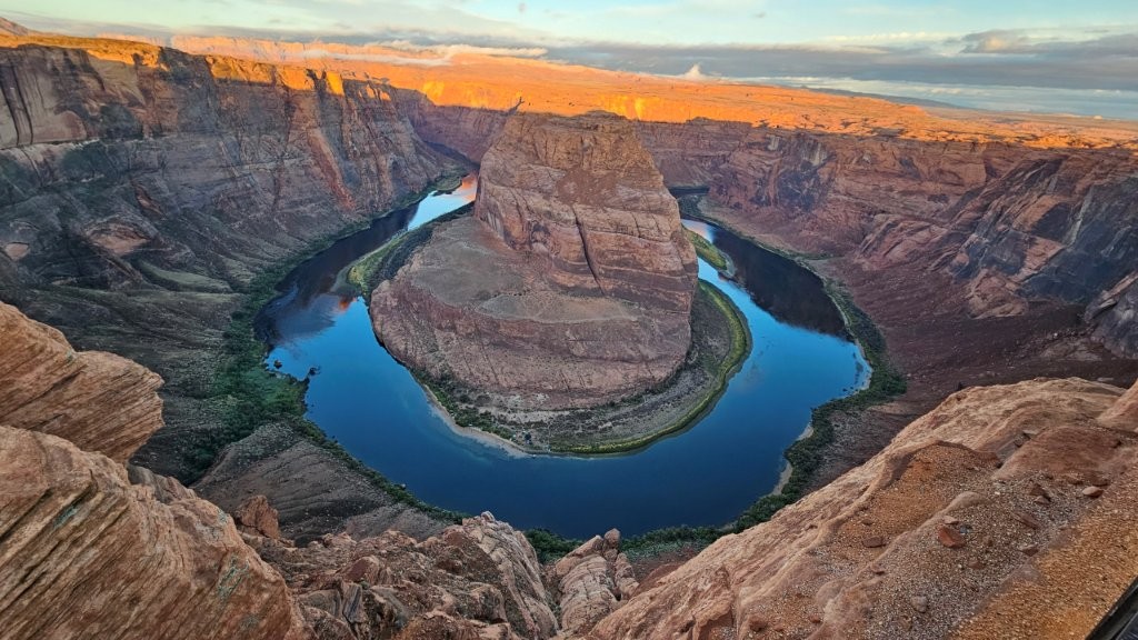
We were VERY curious to see how things had changed in 21 years. So I dug up some old photos we have from that time.
Glen Canyon Dam Overlook
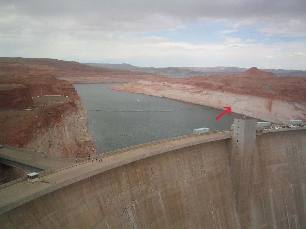
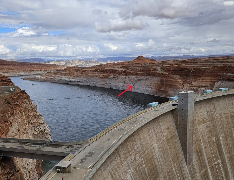
It’s also interesting to note how digital photography has changed. I’m sure I used a Kodak digital camera to take the 2004 picture. The 2025 smart phone picture is much sharper.
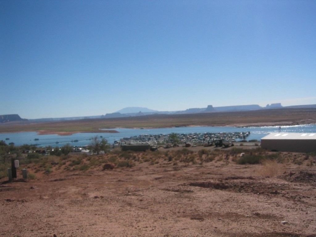
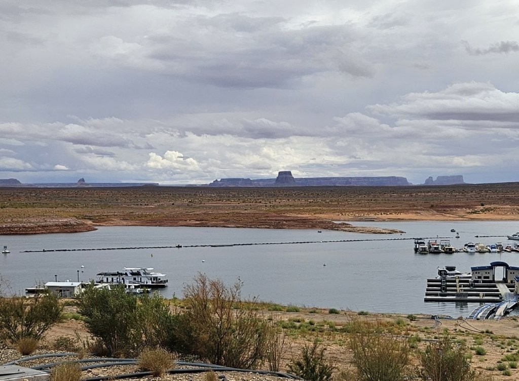
Wahweap Marina
We next visited the marina where we picked up our rental house boat. I had to line up a couple of the landmarks in the distance to figure out where we were standing.

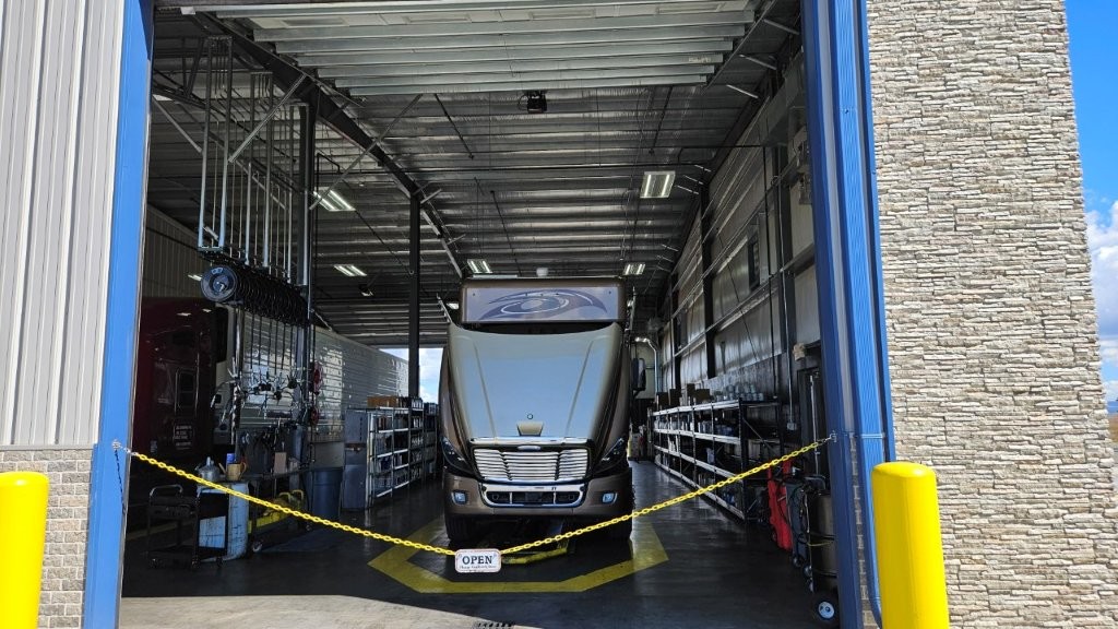
As I hit PUBLISH on this blog post, we are sitting at a Speedco just north of Phoenix. Sandy, our trusty RV, is due for its one year PM (preventative maintenance). Oil change, new filters, etc. etc. etc. Think of a Jiffy Lube, only for semi-trucks.
After this, we are making a beeline for home. We should be there before the end of the week. Then there will be one last blog post with the final numbers from our trip. We engineer types like to collect data. But give me a few days first to find my way around our house again.
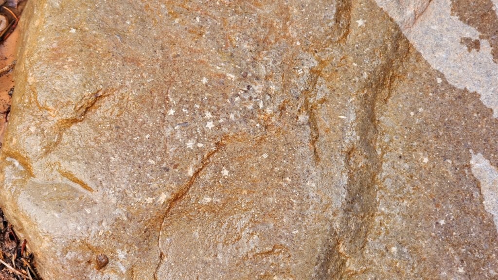
Outstanding! What a spectacular way to end your trip. I loved the pics of every place. I’ve never seen those star fossils before. Very cool. We also went to Zion this summer and enjoyed the bus to the top but we were with friends that were fine with the air-conditioned ride round trip (it was June and HOT). Have never been to Cedar Breaks NM and am looking forward to checking it out. Love that slot canyon, have never been but it would be a fun hike. Have you been to the one here? If not, I’ll take you… That’s the biggest thing about Utah, there are so many NP and NM to see that it’s tough to pick which ones to go to.
The picture of you at Horseshoe bend without shower and coffee, that’s me even when I’m home! LOL I sure hope those adrenalin junkies didn’t’ have a mishap. Those are the type of people we read about all the time.
Thanks for the comparison pictures at Lake Powell. We’ve been there around that area in 2006 and it would be fun to find our pics and compare as well.
Can’t wait to see you guys when you get home and decompress!
Welcome back!
We’ll have to compare Lake Powell notes! Yup, Utah has A LOT to offer, that’s for sure. See you soon.
As always — thanks for the great pictures!!!! Our country sure has a lot of offer and you have done a good job of seeing lots of it and sharing your pictures!!!!!
We have seen a lot of it in the at 11 years, haven’t we? 🙂